FavouritesSign inCreate accountAdd my village

The guide to Spain's villages, one municipality at a time.

Your village is waiting for you.

@8000pueblos

Explore

  • Villages
  • Create my route
  • Experiences

Practical guide

  • Guides
  • About us
  • How it works
  • Village comparison
  • Map of Spain
  • Opportunities
  • Living in a village

Join us

  • Create your account
  • Become an Ambassador
  • For town councils
  • For professionals
  • Contact

© 2026 8000pueblos.com

Some links are affiliate links: if you book, we receive a commission at no cost to you.

SupportPrivacyTermsCookiesLegal notice
en
  • Español
  • English
  • Français
  • Português
  • Italiano
Sign inCreate account
View of AbejuelaPacopac · CC BY-SA 4.0

Abejuela

Mountain hamlet

Abejuela is a municipality located in the province of Teruel, Aragon, Spain. According to the 2018 census (INE), the municipality has a population of 49 inhabitants. It is the southernmost town in Aragon.

Read moreRead less

Sierra de Javalambre rises north of the town and Sierra del Toro to the east.

Text from Wikipedia (CC BY-SA)
Village information

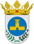
Coat of arms of Abejuela
Province
Teruel
Autonomous community
Aragón
Population (INE 2025)
62
Altitude
1,164 m
Area (IGN)
84.7 km²
Postcode
44422
View on the map
  • Overview
  • See and do
  • Events
  • Stay
  • Eat
  • Live here
  • Opportunities
  • Practical info
  • Gallery

Keep exploring

More villages near Abejuela

Surprise me
Juan Emilio Prades Bel · CC BY-SA 4.0Arcos de las SalinasTeruel · 15 km away
r_santos · CC BY-SA 3.0ManzaneraTeruel · 17 km away
Juan Emilio Prades Bel · CC BY 4.0San AgustínTeruel · 24 km away
Diego Delso · CC BY-SA 4.0AlbentosaTeruel · 24 km away

Where to sleep in Abejuela

2 registered places to stay

See places to stay
PreviousOverviewBack to homeNextEvents

What to see

10 places to explore Abejuela at your own pace. Each number matches its point on the map.

Ask Poblete for a route

Tell me how much time you have and what you like, and I'll put the places in Abejuela in order so you don't go back and forth.

How much time do you have?
How are you getting around?
What do you like? (you can pick several)

Only with places listed for Abejuela.

My route around Abejuela

Tap “+ Add to my route” on the places you want to see. We'll split what you can do on foot from what's better by car.

Places you can add

  1. 1

    1.

    Iglesia

  2. 2

    2.

    Mirador

  3. 3

    3.

    Ermita

  4. 4

    4.

    Ermita

  5. 5

    5.

    Cumbre

  6. 6

    6.

    Cumbre

  7. 7

    7.

    Cumbre

  8. 8

    8.

    Cumbre

  9. 9

    9.

    Cumbre

  10. 10

    10.

    Cumbre

What to do

One plan to experience Abejuela on the move, not just passing through.

Hiking

1 activity

Hiking: GR 10 · Etapa 07: Andilla - Abejuela

More routes on WikilocHiking routes on Google Maps

Places and plans from OpenStreetMap (ODbL): what is mapped within the municipal boundary, by name. If something is missing, it can be added there and will appear here in the next update.

In and around Abejuela

What there really is in the village and around it, with distances. If an activity isn't on this list, we haven't found it nearby.

  • ClimbingVía Ferrata La Mulatica · 10.7 km away, in AndillaGetting there
  • Via ferratasVía Ferrata La Mulatica · 10.7 km away, in AndillaGetting there
  • WineriesBaldovar 923 · 11.5 km away, in AlpuenteGetting there
  • Skiing and snowEstación esquí Javalambre · 25 km away, in Camarena de la SierraGetting there