FavouritesSign inCreate accountAdd my village

The guide to Spain's villages, one municipality at a time.

Your village is waiting for you.

@8000pueblos

Explore

  • Villages
  • Create my route
  • Experiences

Practical guide

  • Guides
  • About us
  • How it works
  • Village comparison
  • Map of Spain
  • Opportunities
  • Living in a village

Join us

  • Create your account
  • For town councils
  • For professionals
  • Contact

© 2026 8000pueblos.com

Some links are affiliate links: if you book, we receive a commission at no cost to you.

SupportPrivacyTermsCookiesLegal notice
en
  • Español
  • English
  • Français
  • Português
  • Italiano
Sign inCreate account
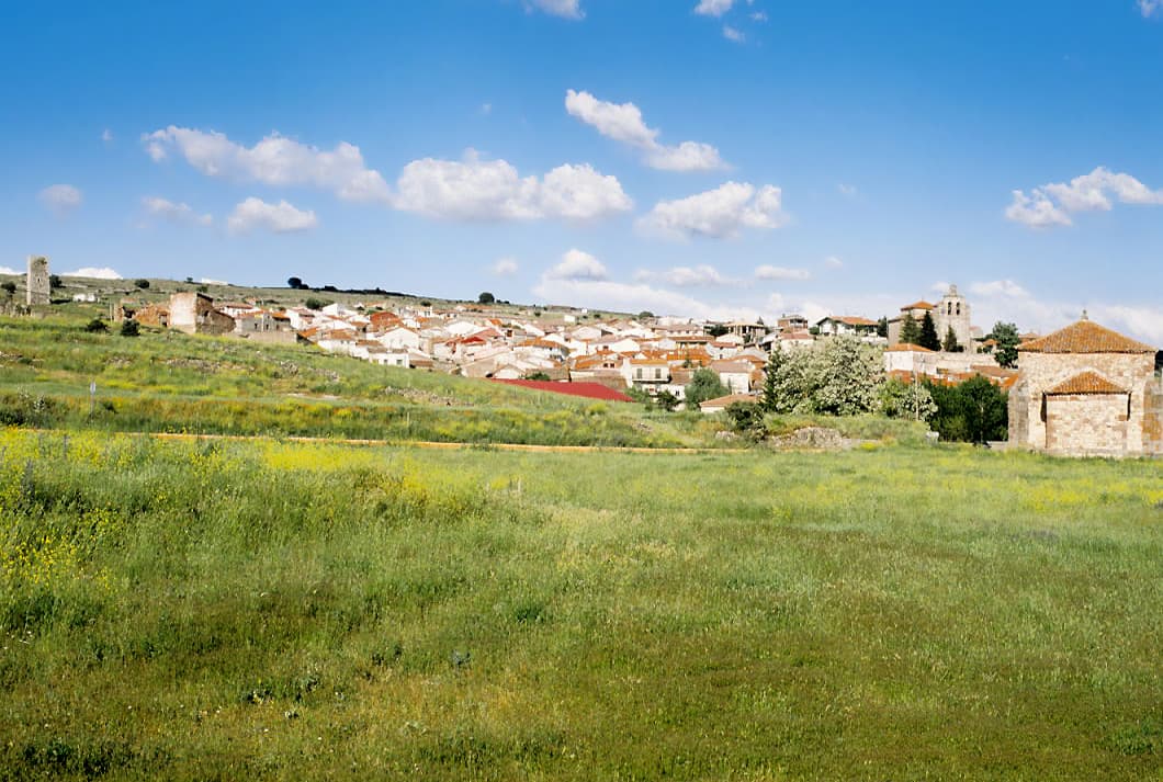
View of AnguitaLBM1948 · CC BY-SA 4.0

Anguita

Mountain village

Anguita is a municipality in the province of Guadalajara, Castile-La Mancha, Spain, with a population of 203 in 2009.

Text from Wikipedia (CC BY-SA)

Village information

Coat of arms of Anguita
Province
Guadalajara
Autonomous community
Castilla-La Mancha
Population (INE 2025)
150
Altitude
1,123 m
Area (IGN)
125 km²
Postcode
19283
Demonym
Anguiteño
View on the map
  • Overview
  • See and do
  • Events
  • Stay
  • Eat
  • Live here
  • Opportunities
  • Practical info
  • Gallery

Keep exploring

More villages near Anguita

Surprise me
Nachosan · CC BY-SA 3.0IniéstolaGuadalajara · 3.6 km away
Juancarluzon · CC BY-SA 4.0LuzónGuadalajara · 7.6 km away
José Ibáñez · CC BY 3.0Alcolea del PinarGuadalajara · 8.4 km away
Papix · Public domainLuzagaGuadalajara · 8.8 km away

Where to sleep in Anguita

1 registered place to stay

See places to stay
PreviousOverviewBack to homeNextEvents

What to see

11 places to explore Anguita at your own pace. Each number matches its point on the map.

Ask Poblete for a route

Tell me how much time you have and what you like, and I'll put the places in Anguita in order so you don't go back and forth.

How much time do you have?
How are you getting around?
What do you like? (you can pick several)

Only with places listed for Anguita.

My route around Anguita

Tap “+ Add to my route” on the places you want to see. We'll split what you can do on foot from what's better by car.

Places you can add

  1. 1

    1.

    El dolmen del Portillo de las Cortes es un yacimiento arqueológico, más concretamente una necrópolis, que data del Neolítico (hace unos 6000 años). Está situado cerca de Aguilar de Anguita (Guadalajara, España), en el término municipal de Anguita.

    DolmenBien de interés cultural

    Dolmen del Portillo de las Cortes
    Wikimedia Commons · Public domain
  2. 2

    2.

    La cueva de la Hoz, o cueva de la Rata, es una cueva que contiene grabados y pinturas prehistóricas y restos arqueológicos, que se encuentra en el parque natural del Alto Tajo, más concretamente en el término municipal de Santa María del Espino, en las orillas del río Linares, a unos 1140 metros…

    CuevaBien de interés cultural

    Cueva de la Hoz
    Nachosan · CC BY-SA 3.0
  3. 3

    3.

    El yacimiento de La Cerca es un antiguo oppidum celtibero y campamento romano situado en el paraje de las Navas, cerca de Aguilar de Anguita, en el término municipal de Anguita, al noreste de la provincia de Guadalajara, en la comunidad de Castilla-La Mancha, España.

    Yacimiento arqueológico

    Campamento romano de La Cerca
    Fujurcitook · CC BY 3.0
  4. 4

    4.

    Yacimiento

  5. 5

    5.

    Iglesia

  6. 6

    6.

    Iglesia

  7. 7

    7.

    Yacimiento

  8. 8

    8.

    Yacimiento

  9. 9

    9.

    Yacimiento

  10. 10

    10.

    Iglesia

  11. 11

    11.

    Iglesia

Monuments from Wikidata; summaries from Wikipedia (CC BY-SA) and photos from Wikimedia Commons, credited to their authors.

What to do

5 plans to experience Anguita on the move, not just passing through.

Hiking

2 activities

Hiking: GR 160 · Camino del Cid (Senderista)

Hiking: El valle de los Milagros

More routes on WikilocHiking routes on Google Maps

Natural areas

1 activity

Zona Periférica de Protección del Parque Natural del Alto Tajo

Getting there

Bike

2 activities

MTB: GR 160 - Camino del Cid BTT

Cycling route: Rural Bike Conecta

Cycling routes on Google Maps

Places and plans from OpenStreetMap (ODbL): what is mapped within the municipal boundary, by name. If something is missing, it can be added there and will appear here in the next update.