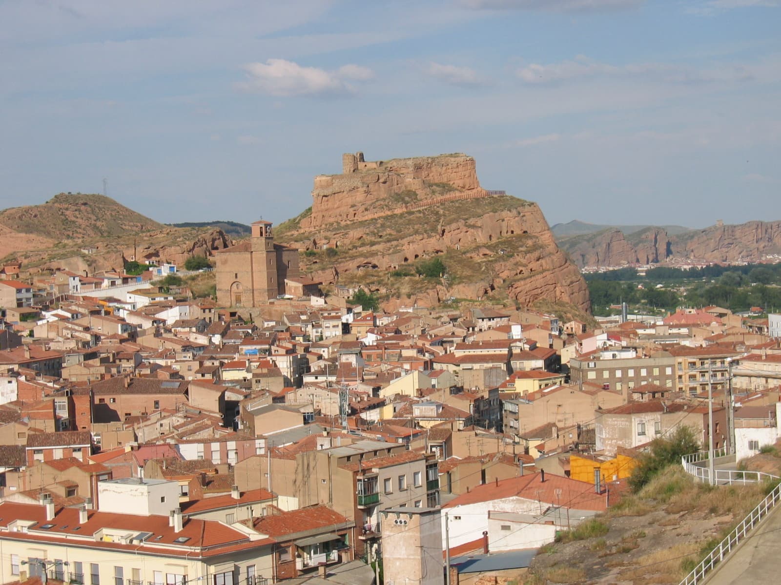
 P.Arpon [2] · CC BY-SA 2.5
Town
Arnedo is the third largest town in La Rioja, Spain. It is located near Calahorra, and has a population of about 15,000 people.
Its economy is based on the shoe industry.
Text from Wikipedia (CC BY-SA)

Keep exploring
13 places to explore Arnedo at your own pace. Each number matches its point on the map.

Tell me how much time you have and what you like, and I'll put the places in Arnedo in order so you don't go back and forth.
Tap “+ Add to my route” on the places you want to see. We'll split what you can do on foot from what's better by car.
El edificio conocido como Chalé de los Sevilla situado en Arnedo (La Rioja, España), era una obra del segundo tercio del siglo XX, construido según el proyecto del arquitecto riojano Agapito del Valle, y constituía el mejor exponente de la arquitectura racionalista en vivienda unifamiliar en La…
MonumentoBien de interés cultural

El castillo de Arnedo es una fortificación localizada en la ciudad de Arnedo, en comunidad autónoma española de La Rioja. Domina la ciudad y el curso del río Cidacos.
Castillo

El Monasterio de Nuestra Señora de Vico está situado en el municipio de Arnedo, La Rioja (España). Se encuentra a 4 kilómetros de su centro urbano, en la carretera hacia Préjano y sobre el río Cidacos.
Abadía de monjas trapenses

Arnedo Arena es una plaza de toros cubierta que se encuentra en la localidad riojana de Arnedo. Es la nueva plaza de toros de la ciudad, que sustituye al viejo recinto, que databa del año 1903.
Plaza de toros

Sitio históricoBien de interés cultural
Las Cuevas de los Cien Pilares comprenden un complejo de cavidades excavados bajo la roca y localizadas en la ciudad de Arnedo,(La Rioja) de lo que presumiblemente pudo ser el Monasterio Rupestre de San Miguel, en Arnedo.
Cueva
Museo
Iglesia
Iglesia
Iglesia
Mirador
Ermita
Ermita
Monuments from Wikidata; summaries from Wikipedia (CC BY-SA) and photos from Wikimedia Commons, credited to their authors.
4 plans to experience Arnedo on the move, not just passing through.
1 activity
1 activity
1 activity
1 activity
Places and plans from OpenStreetMap (ODbL): what is mapped within the municipal boundary, by name. If something is missing, it can be added there and will appear here in the next update.
What there really is in the village and around it, with distances. If an activity isn't on this list, we haven't found it nearby.

