FavouritesSign inCreate accountAdd my village

The guide to Spain's villages, one municipality at a time.

Your village is waiting for you.

@8000pueblos

Explore

  • Villages
  • Create my route
  • Experiences

Practical guide

  • Guides
  • About us
  • How it works
  • Village comparison
  • Map of Spain
  • Opportunities
  • Living in a village

Join us

  • Create your account
  • For town councils
  • For professionals
  • Contact

© 2026 8000pueblos.com

Some links are affiliate links: if you book, we receive a commission at no cost to you.

SupportPrivacyTermsCookiesLegal notice
en
  • Español
  • English
  • Français
  • Português
  • Italiano
Sign inCreate account
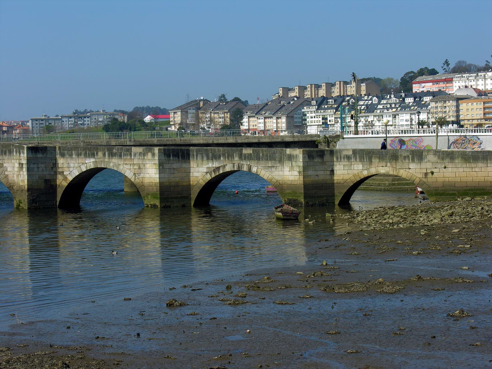
View of CambreWikimedia Commons · CC BY-SA 3.0

Cambre

Coastal town

Cambre is a municipality in the Province of A Coruña, in the autonomous community of Galicia in northwestern Spain. It is located 12 km from the capital city of A Coruña and ten minutes away from the city's airport, Alvedro.

Read moreRead less

According to the 2010 census, the municipality of Cambre includes 23,621 inhabitants spread over its 12 parishes, which occupy 41 square kilometres. The parishes are those of O Temple, Cambre, Sigrás, Anceis, San Lorenzo, Cela, Andeiro, Santa María de Vigo, Bribes, Brexo-Lema, Cecebre and Pravio. It shares municipal boundaries with the neighbouring municipalities of Culleredo, Carral and Oleiros.

The town of Cambre has many sites of interest. Among them are:

The Church of Our Lady Mary of Cambre (Spanish: Iglesia de Santa María de Cambre, Galician: Igrexa de Santa María de Cambre), built around the 12th century; an archaeological museum with a permanent exhibition of the remains of a Roman bathroom and latrine; and the house of Galician writer Wenceslao Fernández Flórez (1885–1964).

The town is located on the Way of St. James (Camino de Santiago), though on the English Way (Camino inglés), used mainly by pilgrims coming from England and Ireland via ship to A Coruña or Ferrol, and from there on foot to Santiago de Compostela.

Text from Wikipedia (CC BY-SA)

Village information

Coat of arms of Cambre
Province
A Coruña
Autonomous community
Galicia
Population (INE 2025)
24,765
Altitude
59 m
Mayor
Diana Piñeiro Fernández
Area (IGN)
40.5 km²
Postcode
15181–15679
View on the map
  • Overview
  • See and do
  • Events
  • Stay
  • Eat
  • Live here
  • Opportunities
  • Practical info
  • Gallery

What to see

  1. 1Iglesia de Santa María de Cambre
  2. 2Villa romana de Cambre
  3. 3Pazo de Cela
  4. 4Pazo de Cecebre
  5. 5Fundación Wenceslao Fernández Flórez
  6. 6Castro
Data from Wikidata and OpenStreetMapSee more

What to do

  1. 1Hiking: Camino Inglés
  2. 2Praia de entrepontes
  3. 3Reserva de la Biosfera Las Mariñas Coruñesas y Tierras de Mandeo
  4. 4Hiking: PR-G 17 · Arredor de Cambre
  5. 5MTB: Mtb Camino Inglés
  6. 6MTB: Senda Ciclable ZEC Abegondo-Cecebre
Data from OpenStreetMapSee more

Photo gallery

See all photos
  • Jose Luis Cernadas Iglesias · CC BY 2.0
  • Nemigo · CC0
  • Nemigo · CC0
  • Wikimedia Commons · CC BY-SA 3.0
  • Alma · CC BY-SA 3.0
  • Wilhelm Lappe · CC BY 2.0
  • 3 places to stayIllustrative photo · Unsplash

    Accommodation

    3 places to stay in Cambre

    See places to stay
  • 30 restaurantsIllustrative photo · David Adam Kess · CC BY-SA 4.0

    Eat

    30 restaurants in Cambre

    See where to eat
  • 6 experiencesIllustrative photo · Luis Rogelio HM · CC BY-SA 2.0

    Experiences

    6 experiences in Cambre

    See experiences

Useful information

Everything you need for your visit or your day-to-day

Tap a row to see it on the map and how far away it is.

Town council

    • Phone: 981 61 31 28
    • Official website: www.cambre.org
    • Email: cambre@cambre.org

Services and transport

Travelling with your pet

Parks, beaches and places to stay that OpenStreetMap marks as dog-friendly. Many places allow dogs without it being marked: ask when you book.

Education, sport and elderly care

Connectivity

  • Fibre broadband· of homes87 %
  • 4G mobile coverage· of homes100 %
  • 5G coverage· of homes100 %

No data on: tourist office, EV chargers, street market.

Data from OpenStreetMap (ODbL), extract from October 2026: we count what is mapped within the municipal boundary. "No data" means OpenStreetMap doesn't have it, not that it doesn't exist. Completed with Overture Maps (CDLA-Permissive-2.0): the pharmacies, health centres, petrol stations, banks, cash machines, food shops and schools that OpenStreetMap was missing. Town hall contact details: General Database of Local Entities (Spanish Ministry of Finance); tourist offices: each region's open registry, where it publishes one. Connectivity: Spanish Ministry for Digital Transformation, % of homes covered in June 2025.

Cambre Town Hall

Municipal information, services, procedures and grants.

Go to municipal information

Keep exploring

More villages near Cambre

Surprise me
Jose Antonio Gil Martínez. FREECAT from Vigo · CC BY 2.0CulleredoA Coruña · 4 km away
Vilachan · CC BY-SA 3.0OleirosA Coruña · 5.1 km away
PepedoCouto · CC BY-SA 3.0CarralA Coruña · 7.2 km away
-Merce- · CC BY-SA 2.0BergondoA Coruña · 9.4 km away

Where to sleep in Cambre

3 registered places to stay

See places to stay
Back to homeNextSee and do