FavouritesSign inCreate accountAdd my village

The guide to Spain's villages, one municipality at a time.

Your village is waiting for you.

@8000pueblos

Explore

  • Villages
  • Create my route
  • Experiences

Practical guide

  • Guides
  • About us
  • How it works
  • Village comparison
  • Map of Spain
  • Opportunities
  • Living in a village

Join us

  • Create your account
  • For town councils
  • For professionals
  • Contact

© 2026 8000pueblos.com

Some links are affiliate links: if you book, we receive a commission at no cost to you.

SupportPrivacyTermsCookiesLegal notice
en
  • Español
  • English
  • Français
  • Português
  • Italiano
Sign inCreate account
View of CandilicheraDiego Delso · CC BY-SA 4.0

Candilichera

Mountain hamlet

Candilichera is a municipality located in the province of Soria, Castile and León, Spain. According to the 2004 census (INE), the municipality had a population of 204 inhabitants.

Text from Wikipedia (CC BY-SA)
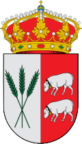
Village information

Coat of arms of Candilichera
Province
Soria
Autonomous community
Castilla y León
Population (INE 2025)
99
Altitude
1,005 m
Area (IGN)
44.8 km²
Postcode
42134
View on the map
  • Overview
  • See and do
  • Events
  • Stay
  • Eat
  • Live here
  • Opportunities
  • Practical info
  • Gallery

Keep exploring

More villages near Candilichera

Surprise me
Miguel Ángel García. from Ólvega., España · CC BY 2.0Cabrejas del CampoSoria · 3.7 km away
Miguel Ángel García, on Flickr · CC BY 2.0AliudSoria · 6.8 km away
Luis Rogelio HM · CC BY-SA 2.0Almenar de SoriaSoria · 8.8 km away
Miguel Ángel García. · CC BY 2.0ArancónSoria · 11 km away

Where to sleep in Candilichera

1 registered place to stay

See places to stay
PreviousOverviewBack to homeNextEvents

What to see

2 places to explore Candilichera at your own pace. Each number matches its point on the map.

Ask Poblete for a route

Tell me how much time you have and what you like, and I'll put the places in Candilichera in order so you don't go back and forth.

How much time do you have?
How are you getting around?
What do you like? (you can pick several)

Only with places listed for Candilichera.

My route around Candilichera

Tap “+ Add to my route” on the places you want to see. We'll split what you can do on foot from what's better by car.

Places you can add

  1. 1

    1.

    Ermita

  2. 2

    2.

    Ruinas

What to do

3 plans to experience Candilichera on the move, not just passing through.

Hiking

2 activities

Hiking: Camino de Santiago de Sagunto

Hiking: Camino Jacobeo Castellano-Aragonés: Pozalmuro-Soria

More routes on WikilocHiking routes on Google Maps

Bike

1 activity

Cycling route: Vía Verde Santander-Mediterráneo (Valcorba - Ciria)

Cycling routes on Google Maps

Places and plans from OpenStreetMap (ODbL): what is mapped within the municipal boundary, by name. If something is missing, it can be added there and will appear here in the next update.