 Paulaherminia · CC BY-SA 4.0
Town
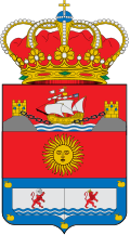
Corvera de Asturias (Asturian: Corvera) is a municipality in the principality of Asturias in northern Spain. It shares a boundary to the north with Avilés and Gozón; to the east with Carreño and Gijón; to the south with Llanera and Illas and to the west with Castrillón. Its capital, Nubledo, has a population of more than 300 residents.
Corvera is the most eastern of the four counties forming the Great County of Aviles. It is situated in the northern-central area of the Principality of Asturias. It is 45.48 km2 (17.56 sq mi) in size and has a population of over 16,000 residents, mainly concentrated in the villages of Las Vegas and Los Campos. The main roads to get there are AS-19, AS-17 and A-8. The A-8 proceeds to Tabaza (Carreño) and the shopping centre Parque Astur.
Text from Wikipedia (CC BY-SA)
Keep exploring
14 places to explore Corvera de Asturias at your own pace. Each number matches its point on the map.

Tell me how much time you have and what you like, and I'll put the places in Corvera de Asturias in order so you don't go back and forth.
Tap “+ Add to my route” on the places you want to see. We'll split what you can do on foot from what's better by car.
El palacio de los Rodríguez de León es una construcción palaciega rural que se levanta junto a la aldea de Overo, en la parroquia de Trasona y concejo de Corvera de Asturias (España). Data de mediados del siglo XV, fue ampliado en el siglo XVII y reformado a fines del XIX.
MansiónBien de interés cultural

Aldea
Lugar de Asturias
El Cueto (oficialmente, en asturiano, El Cuetu) es una aldea de la parroquia corverana de Trasona, en el Principado de Asturias, España.
Aldea
Taújo (en asturiano Taúxu y oficialmente: Taújo/Taúxu)
Aldea
Iglesia
Iglesia
Iglesia
Cascada
Iglesia
Iglesia
Ermita
Ermita
Lugar
Monuments from Wikidata; summaries from Wikipedia (CC BY-SA) and photos from Wikimedia Commons, credited to their authors.
6 plans to experience Corvera de Asturias on the move, not just passing through.
2 activities
1 activity
1 activity
2 activities
Places and plans from OpenStreetMap (ODbL): what is mapped within the municipal boundary, by name. If something is missing, it can be added there and will appear here in the next update.
What there really is in the village and around it, with distances. If an activity isn't on this list, we haven't found it nearby.

