 Zarateman · CC0
Village
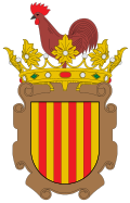
Gallur (population 2,925) is a small town and municipality in the Spanish Autonomical Region of Aragón, province of Zaragoza. The town of Gallur is located on a plain which stretches from the West Bank until the Moncayo High River Ebro, in the so-called Somontano Moncayo, seated on the right bank.
Text from Wikipedia (CC BY-SA)
1 place to stay in Gallur
See places to stay2 restaurants in Gallur
See where to eat3 experiences in Gallur
See experiencesEverything you need for your visit or your day-to-day
Tap a row to see it on the map and how far away it is.
Parks, beaches and places to stay that OpenStreetMap marks as dog-friendly. Many places allow dogs without it being marked: ask when you book.
No data on: tourist office, EV chargers, motorhomes, street market, nursery school, secondary school, pool, care home.
Data from OpenStreetMap (ODbL), extract from October 2026: we count what is mapped within the municipal boundary. "No data" means OpenStreetMap doesn't have it, not that it doesn't exist. Completed with Overture Maps (CDLA-Permissive-2.0): the pharmacies, health centres, petrol stations, banks, cash machines, food shops and schools that OpenStreetMap was missing. Town hall contact details: General Database of Local Entities (Spanish Ministry of Finance); tourist offices: each region's open registry, where it publishes one. Connectivity: Spanish Ministry for Digital Transformation, % of homes covered in June 2025.
Municipal information, services, procedures and grants.
Keep exploring


