FavouritesSign inCreate accountAdd my village

The guide to Spain's villages, one municipality at a time.

Your village is waiting for you.

@8000pueblos

Explore

  • Villages
  • Create my route
  • Experiences

Practical guide

  • Guides
  • About us
  • How it works
  • Village comparison
  • Map of Spain
  • Opportunities
  • Living in a village

Join us

  • Create your account
  • For town councils
  • For professionals
  • Contact

© 2026 8000pueblos.com

Some links are affiliate links: if you book, we receive a commission at no cost to you.

SupportPrivacyTermsCookiesLegal notice
en
  • Español
  • English
  • Français
  • Português
  • Italiano
Sign inCreate account
View of GandiaJoanbanjo · Public domain

Gandia

City

Gandia, in Valencian, spelled Gandía in Spanish, is a city and municipality in the Valencian Community, eastern Spain on the Mediterranean. Gandia is located on the Costa de Valencia, 65 kilometres (40 mi) south of Valencia and 110 km (68 mi) north of Alicante. Vehicles can access the city through road N-332 and AP-7 highway.

Read moreRead less

Gandia operated as an important cultural and commercial centre in the 15th and 16th centuries: in the 15th century it had a university. It was home to several important people, including the poet Ausiàs March (1400-1459) and the novelist Joanot Martorell (1410-1465). It is perhaps best known for the Borja or Borgia, through their family title, Duke of Gandia (originally created in 1399).

As of 2020 Gandia is one of the largest coastal towns in Spain, with a population of over 200,000 during summer, and a centre of commerce and tourism in its region. There are two main zones, Gandia City, which has all the historical monuments, commercial activity, and shopping, and Gandia beach, which has apartments and summer residences used during the summer season. The bars and nightclubs are concentrated in the beach area. As is normal for Spain, nightlife does not begin until well after midnight. The beach and town are actually some 2 km (1 mi) apart, which succeeds in separating summer tourism from day-to-day living.

Text from Wikipedia (CC BY-SA)
Village information

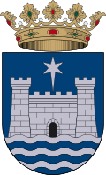
Coat of arms of Gandia
Province
Valencia
Population (INE 2025)
83,135
Altitude
37 m
Area (IGN)
62.5 km²
District
Safor
Postcode
46700–46730
View on the map
  • Overview
  • See and do
  • Events
  • Stay
  • Eat
  • Live here
  • Opportunities
  • Practical info
  • Gallery

What to see

  1. 1Insigne Colegiata de Santa María la Asunción de Gandía
  2. 2Palacio Ducal de Gandía
  3. 3Castillo de Bayrén
  4. 4Alquería del Duc
  5. 5Alquería fortificada Torre dels Pares
  6. 6El Morabet
Data from WikidataSee more

What to do

  1. 1Hiking: El Camí IT5TR5 El Camí del Sud: de Dénia a Castelló de la Plana
  2. 2Paraje Natural Municipal El Surar
  3. 3Paraje Natural Municipal Parpalló-Borrell
  4. 4Hiking: PR-CV 60 · De Barx a la Drova
  5. 5Climbing at Gandia
  6. 6Climbing at Gandía - sector topdeckio
Data from OpenStreetMapSee more
  • 35 places to stayIllustrative photo · Unsplash

    Accommodation

    35 places to stay in Gandia

    See places to stay
  • 281 restaurantsIllustrative photo · Jessica Spengler · CC BY 2.0

    Eat

    281 restaurants in Gandia

    See where to eat
  • 8 experiencesIllustrative photo · Alberto-g-rovi · CC BY-SA 3.0

    Experiences

    8 experiences in Gandia

    See experiences

Useful information

Everything you need for your visit or your day-to-day

Tap a row to see it on the map and how far away it is.

Town council

    • Phone: 962 95 94 00
    • Official website: www.gandia.es
    • Website: www.gandia.org
    • Email: ajuntament@gandia.org

Services and transport

Travelling with your pet

Parks, beaches and places to stay that OpenStreetMap marks as dog-friendly. Many places allow dogs without it being marked: ask when you book.

Education, sport and elderly care

Connectivity

  • Fibre broadband· of homes99 %
  • 4G mobile coverage· of homes100 %
  • 5G coverage· of homes100 %

No data on: tourist office, care home.

Data from OpenStreetMap (ODbL), extract from October 2026: we count what is mapped within the municipal boundary. "No data" means OpenStreetMap doesn't have it, not that it doesn't exist. Completed with Overture Maps (CDLA-Permissive-2.0): the pharmacies, health centres, petrol stations, banks, cash machines, food shops and schools that OpenStreetMap was missing. Town hall contact details: General Database of Local Entities (Spanish Ministry of Finance); tourist offices: each region's open registry, where it publishes one. Connectivity: Spanish Ministry for Digital Transformation, % of homes covered in June 2025.

Gandia Town Hall

Municipal information, services, procedures and grants.

Go to municipal information

Keep exploring

More villages near Gandia

Surprise me
Zarateman · CC0BenirredràValencia · 1.1 km away
19Tarrestnom65 · CC BY-SA 4.0Real de GandíaValencia · 2.2 km away
19Tarrestnom65 · CC BY-SA 4.0DaimúsValencia · 2.7 km away
19Tarrestnom65 · CC BY-SA 4.0AlmoinesValencia · 2.9 km away

Where to sleep in Gandia

35 registered places to stay

See places to stay
Back to homeNextSee and do