FavouritesSign inCreate accountAdd my village

The guide to Spain's villages, one municipality at a time.

Your village is waiting for you.

@8000pueblos

Explore

  • Villages
  • Create my route
  • Experiences

Practical guide

  • Guides
  • About us
  • How it works
  • Village comparison
  • Map of Spain
  • Opportunities
  • Living in a village

Join us

  • Create your account
  • For town councils
  • For professionals
  • Contact

© 2026 8000pueblos.com

Some links are affiliate links: if you book, we receive a commission at no cost to you.

SupportPrivacyTermsCookiesLegal notice
en
  • Español
  • English
  • Français
  • Português
  • Italiano
Sign inCreate account
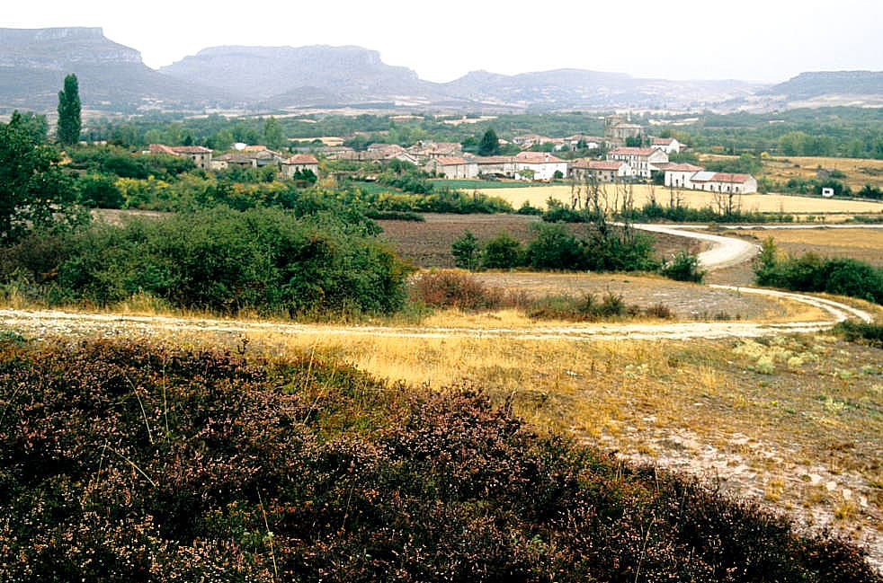
View of HumadaLBM1948 · CC BY-SA 4.0

Humada

Village

Humada is a municipality located in the province of Burgos, Castile and León, Spain. According to the 2004 census (INE), it has a population of 177 inhabitants. Of those inhabitants, a small minority are of French descent.

Text from Wikipedia (CC BY-SA)

Village information

Province
Burgos
Autonomous community
Castilla y León
Population (INE 2025)
114
Altitude
955 m
Area (IGN)
87.1 km²
Postcode
09124
View on the map
  • Overview
  • See and do
  • Events
  • Stay
  • Eat
  • Live here
  • Opportunities
  • Practical info
  • Gallery

Keep exploring

More villages near Humada

Surprise me
Zarateman · CC BY-SA 3.0Valle de ValdelucioBurgos · 5.6 km away
Jesús Gómez Fernández · CC BY 4.0Basconcillos del TozoBurgos · 8.6 km away
Luis Rogelio HM · CC BY-SA 2.0Rebolledo de la TorreBurgos · 12 km away
MottaW · CC BY-SA 3.0SotresgudoBurgos · 13 km away

Where to sleep in Humada

1 registered place to stay

See places to stay
PreviousOverviewBack to homeNextEvents

What to see

11 places to explore Humada at your own pace. Each number matches its point on the map.

Ask Poblete for a route

Tell me how much time you have and what you like, and I'll put the places in Humada in order so you don't go back and forth.

How much time do you have?
How are you getting around?
What do you like? (you can pick several)

Only with places listed for Humada.

My route around Humada

Tap “+ Add to my route” on the places you want to see. We'll split what you can do on foot from what's better by car.

Places you can add

  1. 1

    1.

    El yacimiento arqueológico de La Ulaña se localiza al noroeste de la provincia de Burgos (España) en el término municipal de Humada, sobre un destacado cerro de aproximadamente 586 hectáreas llamado la Peña Ulaña, que presenta una orientación noroeste-suroeste y se encuentra delimitado por…

    Yacimiento arqueológicoBien de interés cultural

    La Ulaña
    Nicolas Gallego Rojas · CC BY-SA 4.0
  2. 2

    2.

    Yacimiento

  3. 3

    3.

    Yacimiento

  4. 4

    4.

    Cascada

  5. 5

    5.

    Iglesia

  6. 6

    6.

    Iglesia

  7. 7

    7.

    Iglesia

  8. 8

    8.

    Iglesia

  9. 9

    9.

    Cascada

  10. 10

    10.

    Cascada

  11. 11

    11.

    Iglesia

Monuments from Wikidata; summaries from Wikipedia (CC BY-SA) and photos from Wikimedia Commons, credited to their authors.

What to do

We're completing the Humada guide village by village.

Places and plans from OpenStreetMap (ODbL): what is mapped within the municipal boundary, by name. If something is missing, it can be added there and will appear here in the next update.

More walks near Humada

Routes shared by hikers and waymarked trails, with their map and elevation profile.

See routes on WikilocHiking routes on Google Maps