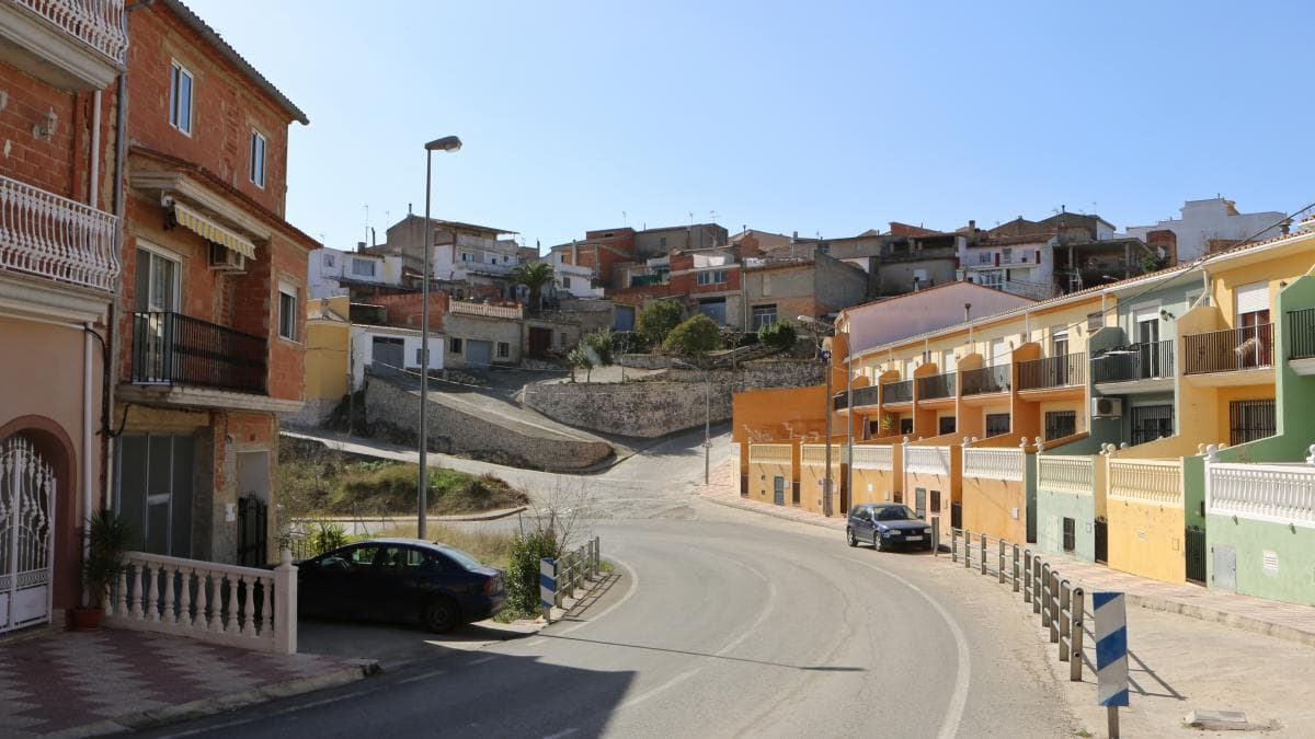
 Fructuos · CC BY 3.0
Village
Llutxent is a town located in the eastern part of Spain, in the Valencian Community, within the comarca of the Vall d'Albaida, 80 km south of Valencia and 110 km north of Alicante. As of 2016, it is inhabited by 2,402 people.
The town's economy is based on agriculture, construction, transport and the manufacture of pallets, and a small services sector.
The town was first settled by Ancient Romans.
Llutxent is host to one of the most popular Moors and Christians celebrations during the end of April, attracting many people around the Valencian Community to see the festival.
Text from Wikipedia (CC BY-SA)

Keep exploring
10 places to explore Llutxent at your own pace. Each number matches its point on the map.

Tell me how much time you have and what you like, and I'll put the places in Llutxent in order so you don't go back and forth.
Tap “+ Add to my route” on the places you want to see. We'll split what you can do on foot from what's better by car.
El monasterio del Corpus Christi situado en el término municipal de Llutxent (Valencia), es una edificación conventual que tiene sus orígenes en una ermita del siglo XIII y que fue renovada en el siglo XVIII.
MonasterioBien de interés cultural

El castillo de Xio, castillo de Chío o Castell de Xiu en valenciano, es una construcción defensiva militar árabe que se sitúa en el término municipal de Luchente (Valencia) España. Fue construido en el siglo XII, durante el periodo almohade.
CastilloBien de interés cultural

El Castillo Palacio Señorial de Llutxent, también cocido como Palau Vell o Palacio de los Próxita, está ubicado en el casco urbano del municipio del mismo nombre, en la calle Castillo, en la comarca del Valle de Albaida, en la provincia de Valencia.
Casa señorialBien de interés cultural

La Ermita de la Consolación situada en el camino de la Costa en el término municipal de Llutxent (Provincia de Valencia, España) fue fundada en 1772, por unos peregrinos catalanes que frecuentaban el Monasterio en el paraje donde ya había existido una Ermita bajo la advocación de San Cosme y San…
ErmitaBien de interés cultural

La cruz de la Subida de la Costa (cruz votiva del siglo XIV), está ubicada junto a la Ermita de la Consolación, en el término de Llutxent, en la comarca del Valle de Albaida, en la provincia de Valencia.
Cruz de términoBien de interés cultural

La cruz de Término de Llutxent, también llamada “Creu de Roquises”, se ubica en el mentado municipio de Llutxent, en la comarca del Valle de Albaida, en la provincia de Valencia.
Cruz de términoBien de interés cultural

Iglesia de estilo neoclásica, del siglo XIX.
IglesiaBien de Relevancia Local

Cementerio, del siglo XIX.
CementerioBien inmueble de Etnología
KilnBien inmueble de Etnología
Pozo de nieveBien de Relevancia Local
Monuments from Wikidata; summaries from Wikipedia (CC BY-SA) and photos from Wikimedia Commons, credited to their authors.
3 plans to experience Llutxent on the move, not just passing through.
1 activity
2 activities
Places and plans from OpenStreetMap (ODbL): what is mapped within the municipal boundary, by name. If something is missing, it can be added there and will appear here in the next update.
What there really is in the village and around it, with distances. If an activity isn't on this list, we haven't found it nearby.

