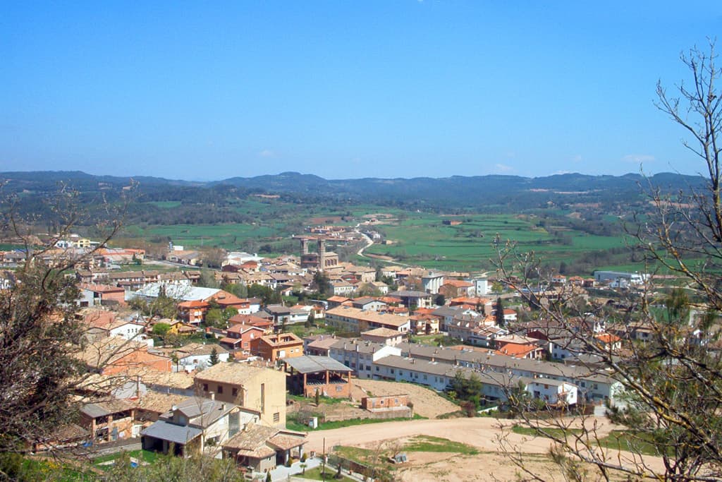
 Jordi D. A. from Barcelona, Catalan Lands · CC BY-SA 2.0
Village
Olost is a municipality in the province of Barcelona, Catalonia, Spain. It has less than 1,200 people, situated on a plain 669 meters above sea level at 20 km from Vic in the center of the ancient shire or comarca of Lluçanès, before in the comarca of Osona. In the center of the village stands the church of Santa Maria d'Olost of monumental size, with a large façade and two bell towers. Its construction started in the 10th century and ended in the 18th century. Near Olost are the two small settlements of Santa Creu de Jutglars (built in 984) and the Vila with Sant Gil de la Vila (built in 1038) and the unusual Castell d'Olost, built in 1155 with added elements of the 14th and 15th centuries, that lies in a depression next to a stream in the district of Orista. Even though it was a fortified farm, it has the structure of a castle; it is nearly hidden from view for protection in the Middle Ages.
Near the village, on the summit of a small hill stands the hermitage of Sant Adjutori (1714)
In the Middle Ages, the village of Olost was on one of the roads taken by troubadours and "jutglars" to cross the Pyrenees. It can be the origin of the name of the settlement of Santa Creu de Jutglars (jugglers or troubadours). Some historians have emphasised that the incidence of the letters OSS, SOS, OS in the names of villages of southern France and Catalunya stands for villages whose names were of Cathar origin and were founded or deeply influenced by Catharism in the 11th–13th centuries.
The village feast in honor of its patron saint is on August 15. The village has a public school and two factories. The nearest train station is in Vic and from there a minibus provides transportation service.
Text from Wikipedia (CC BY-SA)

Festivities in Olost: 8 nov (Feria de Olost. Feria de En Rocaguinarda)See places to stay for those dates
10 places to stay in Olost
See places to stay3 restaurants in Olost
See where to eat3 experiences in Olost
See experiencesEverything you need for your visit or your day-to-day
Tap a row to see it on the map and how far away it is.
Parks, beaches and places to stay that OpenStreetMap marks as dog-friendly. Many places allow dogs without it being marked: ask when you book.
No data on: tourist office, train station, health centre, ATMs, post office, street market, nursery school, secondary school, pool, care home.
Data from OpenStreetMap (ODbL), extract from October 2026: we count what is mapped within the municipal boundary. "No data" means OpenStreetMap doesn't have it, not that it doesn't exist. Completed with Overture Maps (CDLA-Permissive-2.0): the pharmacies, health centres, petrol stations, banks, cash machines, food shops and schools that OpenStreetMap was missing. Town hall contact details: General Database of Local Entities (Spanish Ministry of Finance); tourist offices: each region's open registry, where it publishes one. Connectivity: Spanish Ministry for Digital Transformation, % of homes covered in June 2025.
Municipal information, services, procedures and grants.
Keep exploring


