FavouritesSign inCreate accountAdd my village

The guide to Spain's villages, one municipality at a time.

Your village is waiting for you.

@8000pueblos

Explore

  • Villages
  • Create my route
  • Experiences

Practical guide

  • Guides
  • About us
  • How it works
  • Village comparison
  • Map of Spain
  • Opportunities
  • Living in a village

Join us

  • Create your account
  • For town councils
  • For professionals
  • Contact

© 2026 8000pueblos.com

Some links are affiliate links: if you book, we receive a commission at no cost to you.

SupportPrivacyTermsCookiesLegal notice
en
  • Español
  • English
  • Français
  • Português
  • Italiano
Sign inCreate account
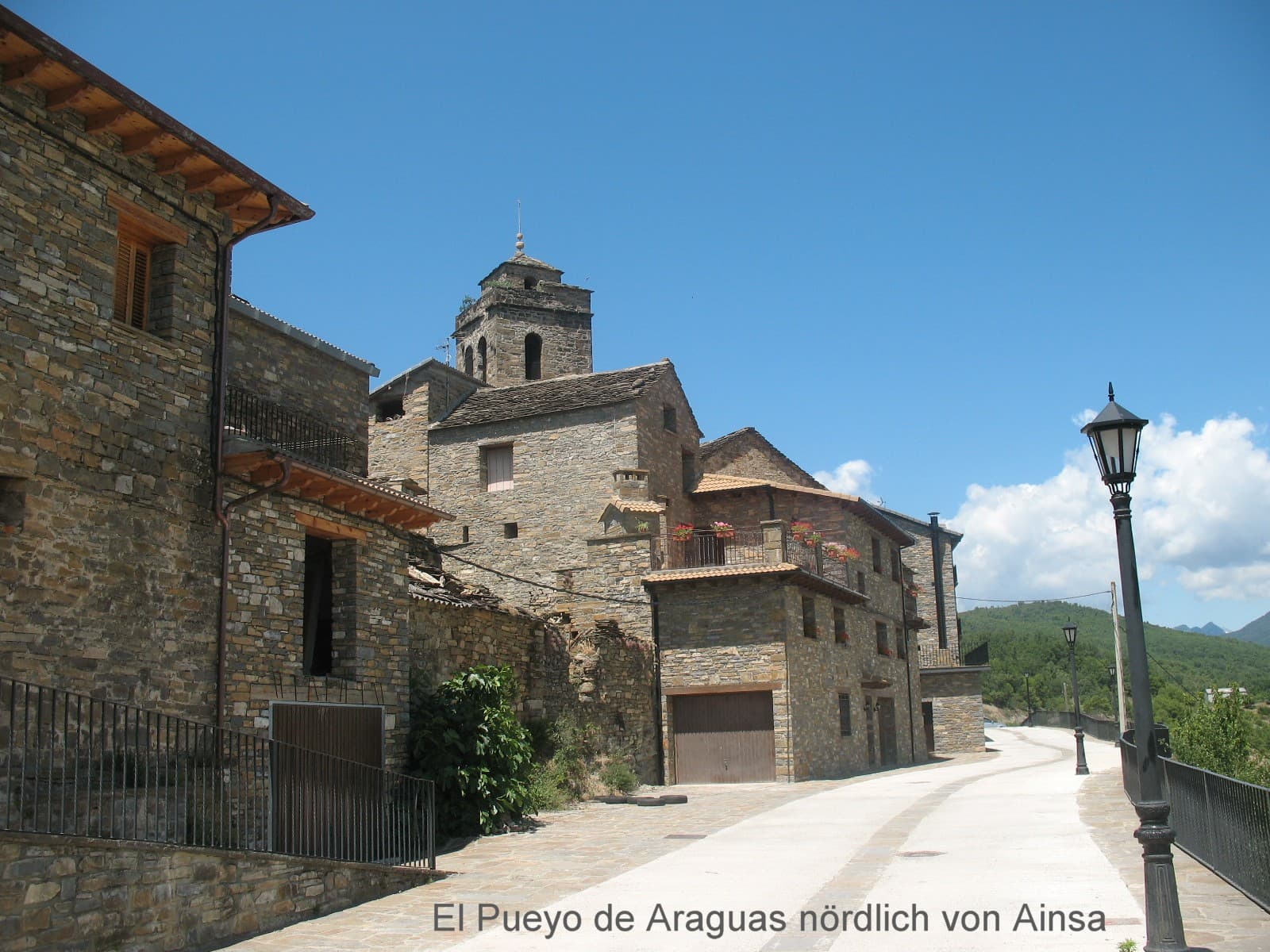
View of El Pueyo de Araguásgesoe62 · CC BY-SA 3.0

El Pueyo de Araguás

Village

El Pueyo de Araguás (in Aragonese: O Pueyo d'Araguás) is a municipality located in the province of Huesca, Aragon, Spain. According to the 2018 census (INE), the municipality has a population of 154 inhabitants.

Text from Wikipedia (CC BY-SA)

Village information

Coat of arms of El Pueyo de Araguás
Province
Huesca
Autonomous community
Aragón
Population (INE 2025)
180
Altitude
684 m
Area (IGN)
62.4 km²
Postcode
22338
View on the map
  • Overview
  • See and do
  • Events
  • Stay
  • Eat
  • Live here
  • Opportunities
  • Practical info
  • Gallery

Keep exploring

More villages near El Pueyo de Araguás

Surprise me
Falk2 · CC BY-SA 4.0LabuerdaHuesca · 2.5 km away
Mikipons · CC BY-SA 3.0 esAínsa-SobrarbeHuesca · 3.1 km away
Juan R. Lascorz · CC BY-SA 3.0LaspuñaHuesca · 6.9 km away
Juan R. Lascorz · CC BY-SA 3.0BoltañaHuesca · 7.6 km away

Where to sleep in El Pueyo de Araguás

17 registered places to stay

See places to stay
PreviousOverviewBack to homeNextEvents

What to see

12 places to explore El Pueyo de Araguás at your own pace. Each number matches its point on the map.

Ask Poblete for a route

Tell me how much time you have and what you like, and I'll put the places in El Pueyo de Araguás in order so you don't go back and forth.

How much time do you have?
How are you getting around?
What do you like? (you can pick several)

Only with places listed for El Pueyo de Araguás.

My route around El Pueyo de Araguás

Tap “+ Add to my route” on the places you want to see. We'll split what you can do on foot from what's better by car.

Places you can add

  1. 1

    1.

    El Real Monasterio de San Victorián (en aragonés y popularmente: San Beturián) es un complejo monástico ubicado en la localidad de Los Molinos, perteneciente al municipio de El Pueyo de Araguás, en la comarca de Sobrarbe, Huesca, Aragón.

    Monasterio hispanoBien de interés cultural

    Real Monasterio de San Victorián
    Carlosky · CC BY-SA 3.0 es
  2. 2

    2.

    La Torre de Casa el Arrendador es una casa torreada que se encuentra en Araguás, pequeña localidad perteneciente al municipio del Pueyo de Araguás, comarca de Sobrarbe, provincia de Huesca, Aragón, España.

    Torre fortificadaBien de interés cultural

    Torre de Casa el Arrendador (Araguás)
    Servicios · CC BY-SA 3.0
  3. 3

    3.

    La ermita de Santa Catalina es una ermita católica consagrada a la advocación de Santa Catalina de Siena que se encuentra en la altura del tozal de Santa Catalina (o «cerro Afeitado»), la mayor altura de la sierra de Arro, en el antiguo término municipal de Los Molinos y actual término municipal…

    ErmitaBien Inventariado del Patrimonio Cultural Aragonés

    Ermita de Santa Catalina
    Juan R. Lascorz · CC BY-SA 3.0
  4. 4

    4.

    Iglesia

  5. 5

    5.

    Cueva

  6. 6

    6.

    Cueva

  7. 7

    7.

    Cueva

  8. 8

    8.

    Ermita

  9. 9

    9.

    Ermita

  10. 10

    10.

    Ermita

  11. 11

    11.

    Ermita

  12. 12

    12.

    Ermita

Monuments from Wikidata; summaries from Wikipedia (CC BY-SA) and photos from Wikimedia Commons, credited to their authors.

What to do

4 plans to experience El Pueyo de Araguás on the move, not just passing through.

Hiking

2 activities

Hiking: GR 19 · Senderos del Sobrarbe

Hiking: PR-HU 139 · Vuelta a la Peña Montañesa

More routes on WikilocHiking routes on Google Maps

Bike

2 activities

MTB: Ruta Transpirenaica en BTT (El Pont de Suert - Broto)

MTB: Sobrarbe. BTT. Ruta 10. De Laspuña a Araguás

Cycling routes on Google Maps

Places and plans from OpenStreetMap (ODbL): what is mapped within the municipal boundary, by name. If something is missing, it can be added there and will appear here in the next update.

In and around El Pueyo de Araguás

What there really is in the village and around it, with distances. If an activity isn't on this list, we haven't found it nearby.

  • Reservoirs and lakesEmbalse de Mediano · 3.6 km away, in Aínsa-SobrarbeGetting there
  • Rafting and canyoningDesembarque aguas bravas Ara, Janovas - Boltaña · 7.9 km away, in Boltaña · 13 within 25 kmGetting there
  • Canoeing and kayakingDesembarque aguas bravas Ara, Janovas - Boltaña · 7.9 km away, in Boltaña · 5 within 20 kmGetting there
  • River beaches and swimming spotsGorgas de Puértolas (ii) · 8.9 km away, in Puértolas · 3 within 15 kmGetting there
  • Spas and hot springsFuente de los Baños o de los Suspiros · 9.5 km away, in FanloGetting there
  • Via ferratasVía Ferrata Foradada del Toscar · 14.9 km away, in Foradada del ToscarGetting there