FavouritesSign inCreate accountAdd my village

The guide to Spain's villages, one municipality at a time.

Your village is waiting for you.

@8000pueblos

Explore

  • Villages
  • Create my route
  • Experiences

Practical guide

  • Guides
  • About us
  • How it works
  • Village comparison
  • Map of Spain
  • Opportunities
  • Living in a village

Join us

  • Create your account
  • For town councils
  • For professionals
  • Contact

© 2026 8000pueblos.com

Some links are affiliate links: if you book, we receive a commission at no cost to you.

SupportPrivacyTermsCookiesLegal notice
en
  • Español
  • English
  • Français
  • Português
  • Italiano
Sign inCreate account
View of Santa Úrsula-wuppertaler · CC BY 4.0

Santa Úrsula

Town

Santa Úrsula is a town and a municipality on the north coast of Tenerife. It is located 6 km east of Puerto de la Cruz and 24 km west of the island's capital, Santa Cruz de Tenerife. The population is 14,545 (2013) and the area is 22.59 km2. The elevation is 290 m. The TF-5 motorway passes through the municipality.

Text from Wikipedia (CC BY-SA)
Village information

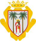
Coat of arms of Santa Úrsula
Province
Santa Cruz de Tenerife
Autonomous community
Canarias
Population (INE 2025)
15,429
Altitude
284 m
Area (IGN)
22.5 km²
Postcode
38390
View on the map
  • Overview
  • See and do
  • Events
  • Stay
  • Eat
  • Live here
  • Opportunities
  • Practical info
  • Gallery

Keep exploring

More villages near Santa Úrsula

Surprise me
Koppchen · CC BY 3.0La Victoria de AcentejoSanta Cruz de Tenerife · 2.4 km away
Ivan Curra · CC BY-SA 3.0La OrotavaSanta Cruz de Tenerife · 5.1 km away
Cayambe · CC BY-SA 4.0Puerto de la CruzSanta Cruz de Tenerife · 5.7 km away
Koppchen · CC BY-SA 3.0El SauzalSanta Cruz de Tenerife · 7.9 km away
PreviousOverviewBack to homeNextEvents

What to see

12 places to explore Santa Úrsula at your own pace. Each number matches its point on the map.

Ask Poblete for a route

Tell me how much time you have and what you like, and I'll put the places in Santa Úrsula in order so you don't go back and forth.

How much time do you have?
How are you getting around?
What do you like? (you can pick several)

Only with places listed for Santa Úrsula.

My route around Santa Úrsula

Tap “+ Add to my route” on the places you want to see. We'll split what you can do on foot from what's better by car.

Places you can add

  1. 1

    1.

    La casa de la Portuguesa, situada en el término municipal de Santa Úrsula, isla de Tenerife, (Canarias, España), es un inmueble que se localiza en la margen meridional de la Carretera Provincial TF-217 a su paso por Santa Úrsula, en las proximidades de El Calvario.

    CasaBien de interés cultural

    Casa de La Portuguesa
    Koppchen · CC BY 3.0
  2. 2

    2.

    La cueva de Bencomo o de Tamaide es una cueva volcánica natural localizada en la isla de Tenerife —Canarias, España— que fue utilizada por los guanches, primeros pobladores de la isla, por lo que constituye un yacimiento arqueológico.

    CuevaBien de interés cultural

    Cueva de Bencomo
    Oliver Abels · CC BY-SA 4.0
  3. 3

    3.

    La iglesia de Santa Úrsula, situada en el término municipal de Santa Úrsula, isla de Tenerife (Canarias, España), es un templo de una sola nave y planta de cruz latina, con capilla mayor y dos laterales separadas por arcos de cantería.

    IglesiaBien de interés cultural

    Iglesia de Santa Úrsula
    Cserranomar · CC BY-SA 4.0
  4. 4

    4.

    CasaBien de interés cultural

    Casa del Capitán
    Oliver Abels · CC BY-SA 4.0
  5. 5

    5.

    Iglesia

  6. 6

    6.

    Iglesia

  7. 7

    7.

    Mirador

  8. 8

    8.

    Mirador

  9. 9

    9.

    Mirador

  10. 10

    10.

    Ermita

  11. 11

    11.

    Ermita

  12. 12

    12.

    Monumento

Monuments from Wikidata; summaries from Wikipedia (CC BY-SA) and photos from Wikimedia Commons, credited to their authors.

What to do

8 plans to experience Santa Úrsula on the move, not just passing through.

Hiking

3 activities

Hiking: Camino de Santiago de Tenerife

Hiking: GR 131 · Camino Natural Anaga-Chasna

Hiking: Camino de Candelaria de Santa Ursula

More routes on WikilocHiking routes on Google Maps

Natural areas

2 activities

Paisaje Protegido de Costa de Acentejo

Getting there

Paisaje Protegido de la Resbala

Getting there

Wineries

1 activity

Bodega Guachinche Churrasco

Getting there

Bike

2 activities

Cycling route: BC 1 - Ruta Norte

Cycling route: Teide * Santa Cruz

Cycling routes on Google Maps

Places and plans from OpenStreetMap (ODbL): what is mapped within the municipal boundary, by name. If something is missing, it can be added there and will appear here in the next update.

In and around Santa Úrsula

What there really is in the village and around it, with distances. If an activity isn't on this list, we haven't found it nearby.

  • WineriesBodega Guachinche Churrasco · in the village · 44 within 15 kmGetting there
  • BeachesPlaya del Ancón · 1.5 km away, in Orotava (La) · 25 within 15 kmGetting there
  • GolfCampo de Golf La Rosaleda · 4 km away, in Puerto de la Cruz · 2 within 20 kmGetting there
  • SurfingQuivers Surf Pro · 5.3 km away · 7 within 20 kmGetting there
  • Water parksLago Martiánez · 5.4 km away · 6 within 25 kmGetting there
  • DivingCentro de Buceo El Cardumen · 6.7 km away, in Puerto de la Cruz · 9 within 20 kmGetting there
  • ClimbingUnnamed on the map · 8.8 km away, in Realejos (Los) · 11 within 20 kmGetting there
  • Sailing and water sportsClub Náutico Social La Galera · 14 km away, in Candelaria · 5 within 20 kmGetting there