FavouritesSign inCreate accountAdd my village

The guide to Spain's villages, one municipality at a time.

Your village is waiting for you.

@8000pueblos

Explore

  • Villages
  • Create my route
  • Experiences

Practical guide

  • Guides
  • About us
  • How it works
  • Village comparison
  • Map of Spain
  • Opportunities
  • Living in a village

Join us

  • Create your account
  • For town councils
  • For professionals
  • Contact

© 2026 8000pueblos.com

Some links are affiliate links: if you book, we receive a commission at no cost to you.

SupportPrivacyTermsCookiesLegal notice
en
  • Español
  • English
  • Français
  • Português
  • Italiano
Sign inCreate account
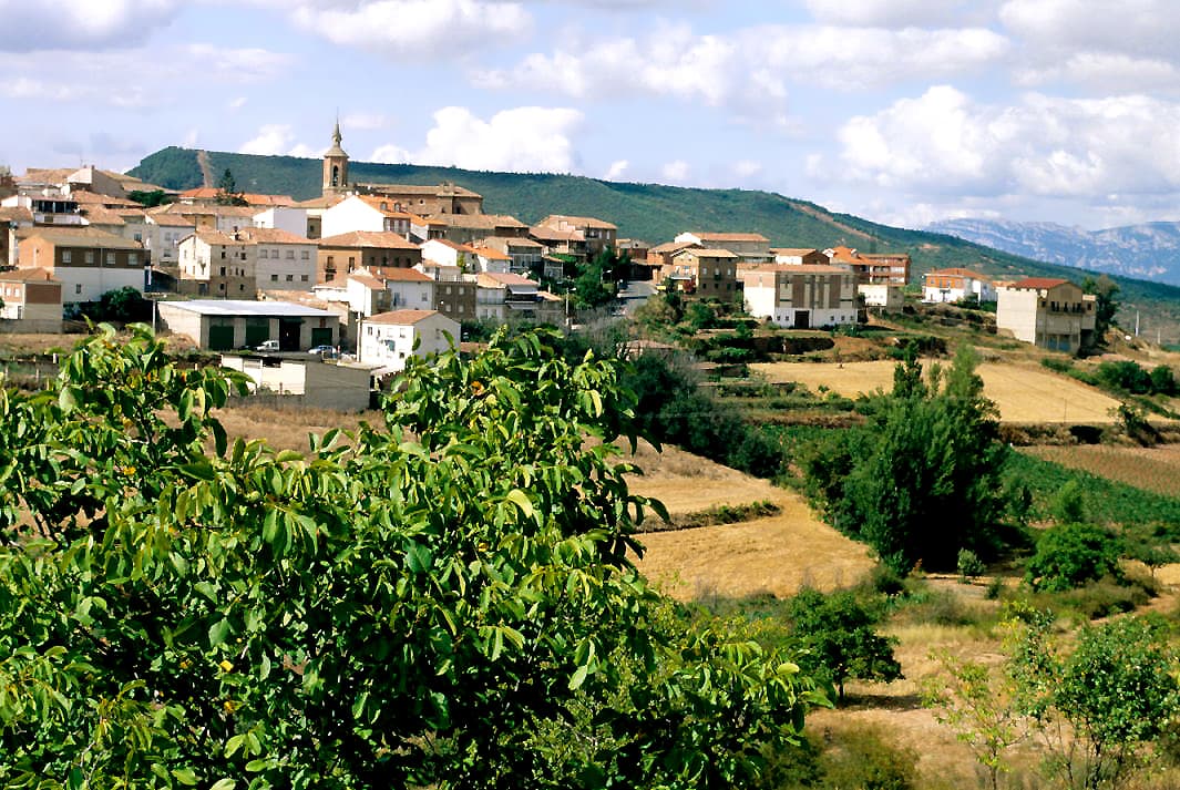
View of SotésLBM1948 · CC BY-SA 4.0

Sotés

Village

Sotés is a village in the province and autonomous community of La Rioja, Spain. The municipality covers an area of 14.6 square kilometres (5.6 sq mi) and as of 2011, had a population of 312 people.

Text from Wikipedia (CC BY-SA)

Village information

Province
La Rioja
Population (INE 2025)
261
Altitude
671 m
Area (IGN)
15.2 km²
Postcode
26371
View on the map
  • Overview
  • See and do
  • Events
  • Stay
  • Eat
  • Live here
  • Opportunities
  • Practical info
  • Gallery

Keep exploring

More villages near Sotés

Surprise me
Gurrea · CC BY-SA 4.0Hornos de MoncalvilloLa Rioja · 1.7 km away
LBM1948 · CC BY-SA 4.0VentosaLa Rioja · 2 km away
Gurrea · CC BY-SA 4.0Daroca de RiojaLa Rioja · 3.6 km away
Gurrea · Public domainMedranoLa Rioja · 4.4 km away
PreviousOverviewBack to homeNextEvents

What to see

One place worth the walk in Sotés.

Ask Poblete for a route

Tell me how much time you have and what you like, and I'll put the places in Sotés in order so you don't go back and forth.

How much time do you have?
How are you getting around?
What do you like? (you can pick several)

Only with places listed for Sotés.

My route around Sotés

Tap “+ Add to my route” on the places you want to see. We'll split what you can do on foot from what's better by car.

Places you can add

  1. 1

    1.

    Cumbre

What to do

5 plans to experience Sotés on the move, not just passing through.

Hiking

2 activities

Hiking: Camino Francés - 03 Logroño a Burgos

Hiking: Camiño Francés (Rutas alternativas)

More routes on WikilocHiking routes on Google Maps

Wineries

1 activity

Bodega Sotes

Getting there

Bike

2 activities

MTB: Camino de Santiago

MTB: Mataconsejera

Cycling routes on Google Maps

Places and plans from OpenStreetMap (ODbL): what is mapped within the municipal boundary, by name. If something is missing, it can be added there and will appear here in the next update.

In and around Sotés

What there really is in the village and around it, with distances. If an activity isn't on this list, we haven't found it nearby.

  • WineriesBodega Sotes · in the village · 108 within 15 kmGetting there
  • ClimbingCampo Activo - Multiaventura · 2.3 km away, in Hornos de Moncalvillo · 2 within 20 kmGetting there
  • GolfClub de Golf Sojuela · 6.9 km away, in Sojuela · 3 within 20 kmGetting there
  • Reservoirs and lakesPantano de La Grajera · 9 km away, in LogroñoGetting there
  • Horse ridingCentro ecuestre Al Andalus · 10.8 km away, in Logroño · 4 within 15 kmGetting there
  • River beaches and swimming spotsPlaya fluvial Río Najerilla · 10.9 km away, in Nájera · 2 within 15 kmGetting there
  • Sailing and water sportsEmbarcadero de Logroño · 14.4 km away, in LogroñoGetting there
  • Water parksPiscina Municipal · 20 km away, in AnguianoGetting there