 Alehadero · CC BY-SA 4.0
Village
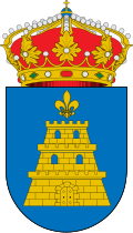
Tabuenca is a municipality located in the province of Zaragoza, Aragon, Spain. According to the 2010 census the municipality has a population of 412 inhabitants. Its postal code is 50547.
The town is located in a mountainous area west of the Moncayo Massif, close to the Sierra de Tabuenca, also known as Sierra del Bollón, after its highest peak, El Bollón (1036 m).
Text from Wikipedia (CC BY-SA)
Keep exploring
10 places to explore Tabuenca at your own pace. Each number matches its point on the map.

Tell me how much time you have and what you like, and I'll put the places in Tabuenca in order so you don't go back and forth.
Tap “+ Add to my route” on the places you want to see. We'll split what you can do on foot from what's better by car.
Ermita
Cumbre
Cumbre
Cumbre
Cumbre
Cumbre
Cumbre
Cumbre
Cumbre
Cumbre
We're completing the Tabuenca guide village by village.
Places and plans from OpenStreetMap (ODbL): what is mapped within the municipal boundary, by name. If something is missing, it can be added there and will appear here in the next update.
Routes shared by hikers and waymarked trails, with their map and elevation profile.
What there really is in the village and around it, with distances. If an activity isn't on this list, we haven't found it nearby.

