 imehling · CC BY-SA 3.0
Coastal village
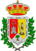
Tazacorte is a town and a municipality on the island of La Palma, Province of Tenerife, Canary Islands, Spain. It is near the coast, in the western part of the island. The population of the municipality is 4,600 (2018) and the area is 11.37 km2. The average elevation is 60 m. Tazacorte is 2 km southwest of Los Llanos de Aridane and 17 km west of the island capital Santa Cruz de La Palma. The inhabitants are known as Bagañetes.
Farmlands, producing almost exclusively bananas, occupy as much as 85% of the land area of Tazacorte. The widespread use, and occasional continued misuse, of insecticides has led to significant concern, as cancer rates for residents is higher than national statistics.
Text from Wikipedia (CC BY-SA)
16 places to stay in Tazacorte
See places to stay25 restaurants in Tazacorte
See where to eat8 experiences in Tazacorte
See experiencesEverything you need for your visit or your day-to-day
Tap a row to see it on the map and how far away it is.
No data on: tourist office, train station, transport, health centre, ATMs, post office, EV chargers, motorhomes, car parks, street market, nursery school, primary school, secondary school, sports facilities, pool, care home.
Data from OpenStreetMap (ODbL), extract from October 2026: we count what is mapped within the municipal boundary. "No data" means OpenStreetMap doesn't have it, not that it doesn't exist. Completed with Overture Maps (CDLA-Permissive-2.0): the pharmacies, health centres, petrol stations, banks, cash machines, food shops and schools that OpenStreetMap was missing. Town hall contact details: General Database of Local Entities (Spanish Ministry of Finance); tourist offices: each region's open registry, where it publishes one. Connectivity: Spanish Ministry for Digital Transformation, % of homes covered in June 2025.
Municipal information, services, procedures and grants.
Keep exploring


