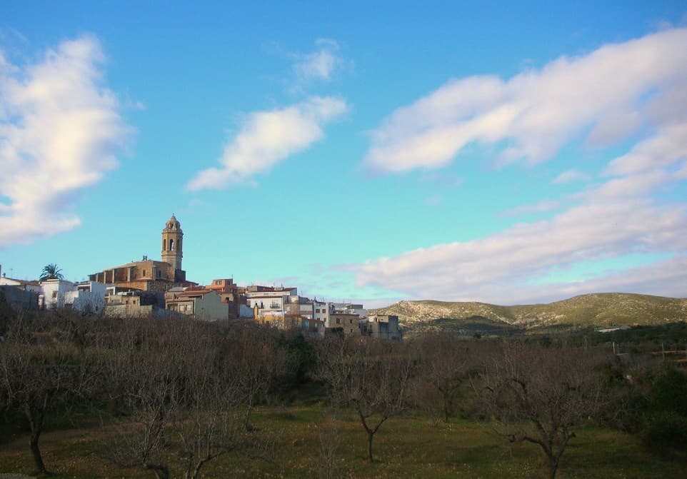
 Xufanc · CC BY-SA 3.0
Village
Traiguera is a town and municipality in the Baix Maestrat comarca, province of Castelló, Valencian Community, Spain. It is part of the Taula del Sénia free association of municipalities.
The town is located in a central position in the comarca, north of the Muntanyes de Cervera. The Serra de Sant Pere mountain range rises on the western side of Traiguera. This town was mentioned as part of Ilercavonia by Ptolemy.
Besides Mediterranean agriculture, mainly almonds, olives and oranges, the town has a traditional ceramic industry, much affected now by the current crisis. The name of the place 'Traiguera' comes from Aegilops geniculata, a coarse cereal that was cultivated until the Middle Ages.
One of the main tourist attractions is the Santuari de la Font de la Salut, located among mountains 2 km south of the town.
Text from Wikipedia (CC BY-SA)

Keep exploring
16 places to explore Traiguera at your own pace. Each number matches its point on the map.

Tell me how much time you have and what you like, and I'll put the places in Traiguera in order so you don't go back and forth.
Tap “+ Add to my route” on the places you want to see. We'll split what you can do on foot from what's better by car.
Los restos de la muralla de Traiguera, en la comarca del Bajo Maestrazgo, y su ampliación abaluartada del siglo XVII, diseminados a lo largo del núcleo más antiguo de la población, se encuentran catalogados, de manera genérica, como bien de interés cultural, con anotación ministerial…
MurallaBien de interés cultural

El Real Santuario de la Virgen de la Salud está situado a dos kilómetros de la población de Traiguera, en la provincia de Castellón.
SantuarioBien de interés cultural

La iglesia de la Asunción de la población de Traiguera, de estilo renacentista, es un templo católico situado en el centro de la población y sede de una parroquia del obispado de Tortosa.
IglesiaBien de Relevancia Local

Árbol singularÁrbol singular
Conjunto históricoBien inmueble de Etnología
Molino hidráulicoBien inmueble de Etnología
Conjunto de estructuras o edificiosBien inmueble de Etnología
Retablo cerámico, del siglo XIX.
Retablo cerámicoBien de Relevancia Local
Retablo cerámico, del siglo XIX.
Retablo cerámicoBien de Relevancia Local
Retablo cerámico, del siglo XIX.
Retablo cerámicoBien de Relevancia Local
Retablo cerámico, del siglo XIX.
Retablo cerámicoBien de Relevancia Local
Retablo cerámico, del siglo XIX.
Retablo cerámicoBien de Relevancia Local
Retablo cerámicoBien de Relevancia Local
Retablo cerámicoBien de Relevancia Local
Cueva
Ruinas
Monuments from Wikidata; summaries from Wikipedia (CC BY-SA) and photos from Wikimedia Commons, credited to their authors.
One plan to experience Traiguera on the move, not just passing through.
1 activity
Places and plans from OpenStreetMap (ODbL): what is mapped within the municipal boundary, by name. If something is missing, it can be added there and will appear here in the next update.
Routes shared by hikers and waymarked trails, with their map and elevation profile.
What there really is in the village and around it, with distances. If an activity isn't on this list, we haven't found it nearby.

