 Seeyou esp · CC BY 3.0
Hamlet
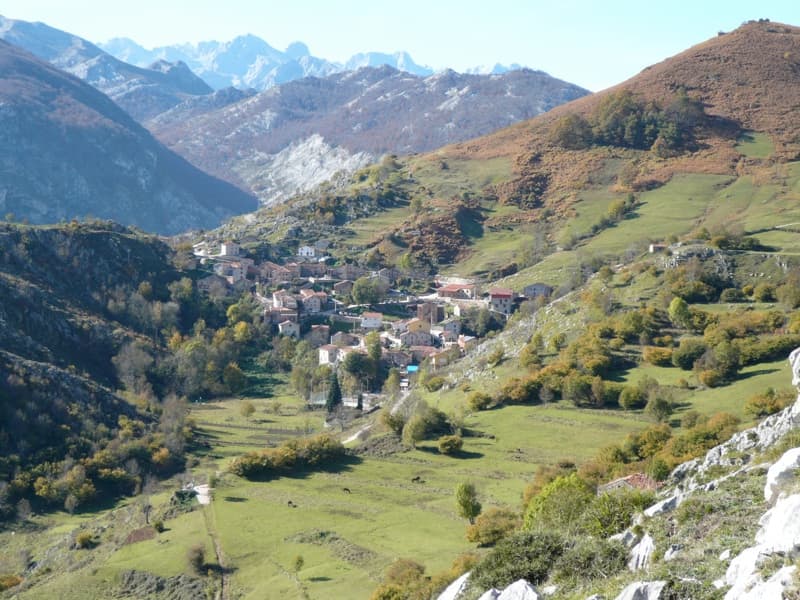
Tresviso is a municipality located in the autonomous community of Cantabria, Spain. The municipality is located 907 m (2,976 ft) above sea level within the Picos de Europa of the Cantabrian Mountains. The village is located on a mountain ledge approximately 800 m (2,600 ft) above the Deva River valley bottom. Despite being in Cantabria, the only road access to Tresviso is a narrow road over a 1,320 m (4,330 ft) high pass from Sotres in the neighbouring province of Asturias. Alternatively, on the Cantabrian side there is a strenuous 3-hour hike from the N621 highway along the Deva featuring many switchbacks.
Text from Wikipedia (CC BY-SA)
Keep exploring
10 places to explore Tresviso at your own pace. Each number matches its point on the map.

Tell me how much time you have and what you like, and I'll put the places in Tresviso in order so you don't go back and forth.
Tap “+ Add to my route” on the places you want to see. We'll split what you can do on foot from what's better by car.
Iglesia
Mirador
Cueva
Cueva
Cueva
Cueva
Cueva
Cueva
Cueva
Cueva
5 plans to experience Tresviso on the move, not just passing through.
3 activities
1 activity
1 activity
Places and plans from OpenStreetMap (ODbL): what is mapped within the municipal boundary, by name. If something is missing, it can be added there and will appear here in the next update.
What there really is in the village and around it, with distances. If an activity isn't on this list, we haven't found it nearby.

