FavouritesSign inCreate accountAdd my village

The guide to Spain's villages, one municipality at a time.

Your village is waiting for you.

@8000pueblos

Explore

  • Villages
  • Create my route
  • Experiences

Practical guide

  • Guides
  • About us
  • How it works
  • Village comparison
  • Map of Spain
  • Opportunities
  • Living in a village

Join us

  • Create your account
  • For town councils
  • For professionals
  • Contact

© 2026 8000pueblos.com

Some links are affiliate links: if you book, we receive a commission at no cost to you.

SupportPrivacyTermsCookiesLegal notice
en
  • Español
  • English
  • Français
  • Português
  • Italiano
Sign inCreate account
View of TurrillasSchumi4ever · CC BY-SA 4.0

Turrillas

Village

Turrillas is a municipality of Almería province, in the autonomous community of Andalusia, Spain.

Read moreRead less

The township is built quite high up on the north-west facing slopes of the Sierra Alhamilla. It is accessed either by a winding road from Lucainena de las Torres or from a road off the main Sorbas to Tabernas N-340a road.

From Turrillas there are views of the opposite Sierras, the Sorbas basin and of the agricultural land use; such land use is primarily revolves around olive production and some almond production. For those interested in agricultural practices there is evidence of old terrace agriculture on the hillside adjacent to the town and also evidence of a qanat irrigation system on the alluvial fan directly below the town.

As of June 18, 2008, a series of Windmills are being erected on the mountain range behind Turrillas, to provide power to the National Grid. Construction began early 2008 with works to widen the roads, in order to transport the large blades and towers needed, temporary wind test antenna have been erected in order to discover the possible amount of electricity to be gained by the windmills. The initial stage of testing was successful. Construction is expected to be finished by the end of 2008.

Text from Wikipedia (CC BY-SA)
Village information

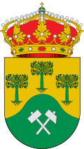
Coat of arms of Turrillas
Province
Almería
Autonomous community
Andalucía
Population (INE 2025)
256
Altitude
840 m
Area (IGN)
38.4 km²
Postcode
04211
View on the map
  • Overview
  • See and do
  • Events
  • Stay
  • Eat
  • Live here
  • Opportunities
  • Practical info
  • Gallery

What to see

  1. 1Iglesia Parroquial de Santa María
  2. 2Cueva Minuto
  3. 3Mirador de Turillas
  4. 4Ermita de San Antonio de Padua
  5. 5Cerro del Minuto
  6. 6Cerro Maciscuela
Data from OpenStreetMapSee more

What to do

  1. 1Hiking: GR 140
  2. 2Hiking: GR 244
  3. 3Paraje Natural de Sierra Alhamilla
  4. 4Hiking: PR-A 383 · Turrillas - Loma del Perro
  5. 5Cycling route: Pico Colativí
Data from OpenStreetMapSee more

Photo gallery

See all photos
  • Ziegler175 · CC BY-SA 4.0
  • Schumi4ever · CC BY-SA 4.0
  • Ziegler175 · CC BY-SA 4.0
  • 2 places to stayIllustrative photo · Toprural · CC BY-SA 2.0

    Accommodation

    2 places to stay in Turrillas

    See places to stay
  • 1 restaurantIllustrative photo · David Adam Kess · CC BY-SA 4.0

    Eat

    1 restaurant in Turrillas

    See where to eat
  • 5 experiencesIllustrative photo · Enrique Amigo · CC BY-SA 4.0

    Experiences

    5 experiences in Turrillas

    See experiences

Useful information

Everything you need for your visit or your day-to-day

Tap a row to see it on the map and how far away it is.

Town council

    • Phone: 950 36 44 15
    • Official website: www.turrillas.es

Services and transport

Travelling with your pet

Parks, beaches and places to stay that OpenStreetMap marks as dog-friendly. Many places allow dogs without it being marked: ask when you book.

Education, sport and elderly care

Connectivity

  • Fibre broadband· of homes63 %
  • 4G mobile coverage· of homes98 %
  • 5G coverage· of homes98 %

No data on: tourist office, train station, petrol stations, banks, supermarkets, post office, EV chargers, motorhomes, street market, nursery school, secondary school, pool, care home.

Data from OpenStreetMap (ODbL), extract from October 2026: we count what is mapped within the municipal boundary. "No data" means OpenStreetMap doesn't have it, not that it doesn't exist. Completed with Overture Maps (CDLA-Permissive-2.0): the pharmacies, health centres, petrol stations, banks, cash machines, food shops and schools that OpenStreetMap was missing. Town hall contact details: General Database of Local Entities (Spanish Ministry of Finance); tourist offices: each region's open registry, where it publishes one. Connectivity: Spanish Ministry for Digital Transformation, % of homes covered in June 2025.

Turrillas Town Hall

Municipal information, services, procedures and grants.

Go to municipal information

Keep exploring

More villages near Turrillas

Surprise me
Eduardo Milla · CC BY-SA 4.0Lucainena de las TorresAlmería · 5.8 km away
Benreis · CC BY-SA 3.0NíjarAlmería · 8.8 km away
Luis Rogelio HM · CC BY-SA 2.0TabernasAlmería · 12 km away
Schumi4ever · CC BY-SA 3.0SorbasAlmería · 14 km away

Where to sleep in Turrillas

2 registered places to stay

See places to stay
Back to homeNextSee and do