FavouritesSign inCreate accountAdd my village

The guide to Spain's villages, one municipality at a time.

Your village is waiting for you.

@8000pueblos

Explore

  • Villages
  • Create my route
  • Experiences

Practical guide

  • Guides
  • About us
  • How it works
  • Village comparison
  • Map of Spain
  • Opportunities
  • Living in a village

Join us

  • Create your account
  • For town councils
  • For professionals
  • Contact

© 2026 8000pueblos.com

Some links are affiliate links: if you book, we receive a commission at no cost to you.

SupportPrivacyTermsCookiesLegal notice
en
  • Español
  • English
  • Français
  • Português
  • Italiano
Sign inCreate account
View of ValleladoRastrojo · CC BY-SA 4.0

Vallelado

Village

Vallelado is a municipality located in the province of Segovia, Castile and León, Spain. According to the 2004 census (INE), the municipality has a population of 831 inhabitants.

Text from Wikipedia (CC BY-SA)
Village information

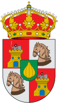
Coat of arms of Vallelado
Province
Segovia
Autonomous community
Castilla y León
Population (INE 2025)
750
Altitude
779 m
Area (IGN)
36.5 km²
Postcode
40213
View on the map
  • Overview
  • See and do
  • Events
  • Stay
  • Eat
  • Live here
  • Opportunities
  • Practical info
  • Gallery

What to see

  1. 1Santo Tomás
  2. 2Molino Minguela
Data from OpenStreetMapSee more
  • Illustrative photo · Valdavia · CC BY-SA 3.0

    Accommodation

    No places to stay listed yet

    See places to stay
  • 1 restaurantIllustrative photo · Jessica Spengler · CC BY 2.0

    Eat

    1 restaurant in Vallelado

    See where to eat
  • Illustrative photo · Àngela Llop · CC BY-SA 4.0

    Experiences

    No experiences listed yet; 2 kinds of activity within 30 km

    See experiences

Useful information

Everything you need for your visit or your day-to-day

Tap a row to see it on the map and how far away it is.

Town council

    • Phone: 921 15 03 01
    • Official website: www.vallelado.org
    • Website: www.vallelado.es
    • Email: info@vallelado.es

Services and transport

Travelling with your pet

Parks, beaches and places to stay that OpenStreetMap marks as dog-friendly. Many places allow dogs without it being marked: ask when you book.

Education, sport and elderly care

Connectivity

  • Fibre broadband· of homes93 %
  • 4G mobile coverage· of homes100 %
  • 5G coverage· of homes48 %

No data on: tourist office, train station, pharmacies, health centre, ATMs, post office, EV chargers, motorhomes, car parks, street market, nursery school, secondary school, care home.

Data from OpenStreetMap (ODbL), extract from October 2026: we count what is mapped within the municipal boundary. "No data" means OpenStreetMap doesn't have it, not that it doesn't exist. Town hall contact details: General Database of Local Entities (Spanish Ministry of Finance); tourist offices: each region's open registry, where it publishes one. Connectivity: Spanish Ministry for Digital Transformation, % of homes covered in June 2025.

Vallelado Town Hall

Municipal information, services, procedures and grants.

Go to municipal information

Keep exploring

More villages near Vallelado

Surprise me
Lourdes Cardenal · CC BY-SA 4.0ChañeSegovia · 7.3 km away
Rastrojo · CC BY-SA 4.0RemondoSegovia · 8.4 km away
BigSus · CC BY 2.5CuéllarSegovia · 9.1 km away
Rastrojo (D•ES) · CC BY-SA 4.0SanchonuñoSegovia · 13 km away
Back to homeNextSee and do