FavouritesSign inCreate accountAdd my village

The guide to Spain's villages, one municipality at a time.

Your village is waiting for you.

@8000pueblos

Explore

  • Villages
  • Create my route
  • Experiences

Practical guide

  • Guides
  • About us
  • How it works
  • Village comparison
  • Map of Spain
  • Opportunities
  • Living in a village

Join us

  • Create your account
  • For town councils
  • For professionals
  • Contact

© 2026 8000pueblos.com

Some links are affiliate links: if you book, we receive a commission at no cost to you.

SupportPrivacyTermsCookiesLegal notice
en
  • Español
  • English
  • Français
  • Português
  • Italiano
Sign inCreate account
View of Velilla del Río CarriónGoldorak · CC BY-SA 4.0

Velilla del Río Carrión

Mountain village

Velilla del Río Carrión (or simply Velilla) is a town and municipality located in Montaña Palentina of the province of Palencia, Castile and León, Spain. According to the 2023 INE census, the municipality has a population of 1,145 inhabitants, the majority of whom live in the town of Velilla itself.

Read moreRead less

The village straddles either side of the Carrión river, a tributary of the Pisuerga and eventually the Duero. It is only 5 kilometres upstream from Guardo, the largest town in the region. Velilla's town centre is overlooked by two prominent mountains: Peña Lampa (1804m, which forms the provincial border between Palencia and León) and the Peña Mayor de Velilla (1869m) in the adjacent Sierra de Brezo.

The wider municipality comprises a geographically large and mountainous area of the far north of Palencia province, incorporating the isolated villages of Otero de Guardo, Alba de los Cardaños, Camporredondo de Alba, Cardaño de Abajo and Cardaño de Arriba. The main landmarks in the area are Espigüete (2450m), the most emblematic mountain in the area, and Pico Murcia (2431m) a nearby pyramid-shaped peak. The town of Velilla (along with Cervera de Pisuerga) is the starting point of the Ruta de los Pantanos or 'Reservoirs Route', a route which follows the P-210 through the Palentine mountains alongside the Compuerto and Camporredondo reservoirs (inaugurated in 1960 and 1930 respectively).

The Cantabri, a pre-Roman tribal federation who lived in northern Iberia in the second half of the first millennium BCE, were the area's first inhabitants and possibly constructed the town's famous Fontes Tamarici.

Text from Wikipedia (CC BY-SA)
Village information

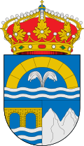
Coat of arms of Velilla del Río Carrión
Province
Palencia
Autonomous community
Castilla y León
Population (INE 2025)
1,104
Altitude
1,121 m
Area (IGN)
200 km²
Postcode
34886
Demonym
velillense
View on the map
  • Overview
  • See and do
  • Events
  • Stay
  • Eat
  • Live here
  • Opportunities
  • Practical info
  • Gallery

Keep exploring

More villages near Velilla del Río Carrión

Surprise me
Alejandro Polanco · CC BY 3.0GuardoPalencia · 4.2 km away
Iñaki Carrascal · CC BY-SA 4.0MantinosPalencia · 8.1 km away
Valdavia · CC BY-SA 3.0Santibáñez de la PeñaPalencia · 9.7 km away
Rodelar · CC BY-SA 4.0Villalba de GuardoPalencia · 12 km away
PreviousEventsBack to homeNextEat

Where to stay in Velilla del Río Carrión

19 places to stay in the village's official tourism register.

Check-in

Check-out

Guests

Your dates and guests carry through to the booking.

Registered places to stay in Velilla del Río Carrión

Those listed in the official tourism register. They have no agreement with 8000pueblos: to find out if they have room, contact them directly. There are also 10 registered holiday rentals.

Data from the official tourism register of Castilla y León. Being registered does not mean they have rooms available.

Official tourism register

Filter by

Type of accommodation
Highlights
Distance from centre
Capacity

19 places to stay

19 places to stay

  • Is this your place? Upload your photos

    Country house

    Hotel Rural Orquidea

    26 bedsIn the village centre

    ContactWebsite
    Data from the official tourism register·
  • Is this your place? Upload your photos

    Country house

    Los Tilares

    12 beds260 m from the centre

    Contact
    Data from the official tourism register·
  • Is this your place? Upload your photos

    Country house

    Casa Peña el Tejo

    8 beds13 km from the centre

    ContactWebsite
    Data from the official tourism register·
  • Is this your place? Upload your photos

    Country house

    Casan i

    8 beds260 m from the centre

    Contact
    Data from the official tourism register·
  • Is this your place? Upload your photos

    Country house

    Casa del Pastor

    6 beds6.2 km from the centre

    Contact
    Data from the official tourism register·
  • Is this your place? Upload your photos

    Country house

    Casa Anti

    5 beds220 m from the centre

    ContactWebsite
    Data from the official tourism register·
  • Is this your place? Upload your photos

    Country house

    Casa Damian

    5 beds11 km from the centre

    Contact
    Data from the official tourism register·
  • Is this your place? Upload your photos

    Country house

    Ruralba

    4 beds14 km from the centre

    ContactWebsite
    Data from the official tourism register·
  • Is this your place? Upload your photos

    Hotel

    Kyomu Resort

    38 beds2.8 km from the centre

    ContactWebsite
    Data from the official tourism register·
  • Is this your place? Upload your photos

    Hotel

    Hotel Pico Espiguete

    21 beds13 km from the centre

    ContactWebsite
    Data from the official tourism register·
  • Is this your place? Upload your photos

    Guesthouse

    Hostal- Bar " Stop

    18 bedsIn the village centre

    ContactWebsite
    Data from the official tourism register·
  • Is this your place? Upload your photos

    Guesthouse

    Areños

    15 beds400 m from the centre

    Contact
    Data from the official tourism register·

Is this your place?

List it on 8000pueblos with your photos, prices and phone number, and it will appear first on the village page.

List my accommodation

Source: Junta de Castilla y León · Registro de Turismo (CC BY 4.0); OpenStreetMap (teléfonos y webs que el registro no publica) (ODbL); Overture Maps Foundation (teléfonos y webs que el registro no publica) (CDLA-Permissive-2.0). Open data retrieved in October 2026; recent openings and closures may not appear yet.