FavouritesSign inCreate accountAdd my village

The guide to Spain's villages, one municipality at a time.

Your village is waiting for you.

@8000pueblos

Explore

  • Villages
  • Create my route
  • Experiences

Practical guide

  • Guides
  • About us
  • How it works
  • Village comparison
  • Map of Spain
  • Opportunities
  • Living in a village

Join us

  • Create your account
  • For town councils
  • For professionals
  • Contact

© 2026 8000pueblos.com

Some links are affiliate links: if you book, we receive a commission at no cost to you.

SupportPrivacyTermsCookiesLegal notice
en
  • Español
  • English
  • Français
  • Português
  • Italiano
Sign inCreate account
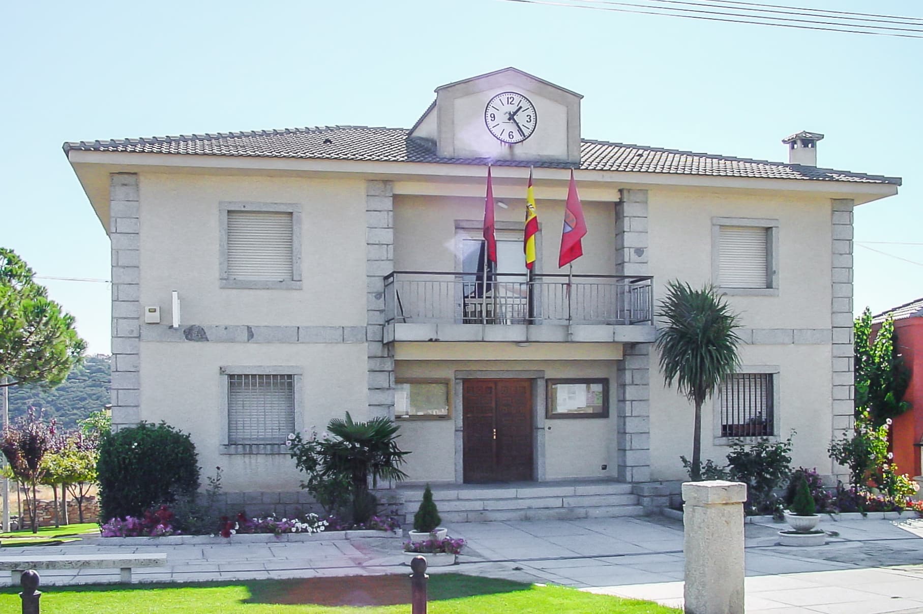
View of VenturadaWikimedia Commons · CC BY-SA 3.0

Venturada

Village

Venturada is a municipality of the Community of Madrid, Spain. In 2022 it had a population of 2445.

Text from Wikipedia (CC BY-SA)

Village information

Coat of arms of Venturada
Province
Madrid
Population (INE 2025)
2,622
Altitude
883 m
Area (IGN)
9.6 km²
Postcode
28729
View on the map
  • Overview
  • See and do
  • Events
  • Stay
  • Eat
  • Live here
  • Opportunities
  • Practical info
  • Gallery

What to see

  1. 1Iglesia de Santiago
  2. 2Atalaya de Venturada
  3. 3Capilla de Cotos
Data from Wikidata and OpenStreetMapSee more

What to do

  1. 1Hiking: Camino Mendocino
Data from OpenStreetMapSee more

Photo gallery

See all photos
  • Gabriel Eustaquio Alcaide · CC BY-SA 4.0
  • Chamanerrimo · CC0
  • Chamanerrimo · CC0
  • Luis Rogelio HM · CC BY-SA 2.0
  • Luis Rogelio HM · CC BY-SA 2.0
  • 4 places to stayIllustrative photo · Valdavia · CC BY-SA 3.0

    Accommodation

    4 places to stay in Venturada

    See places to stay
  • 3 restaurantsIllustrative photo · Basotxerri · CC BY-SA 4.0

    Eat

    3 restaurants in Venturada

    See where to eat
  • 1 experienceIllustrative photo · Alberto-g-rovi · CC BY-SA 3.0

    Experiences

    1 experience in Venturada

    See experiences

Useful information

Everything you need for your visit or your day-to-day

Tap a row to see it on the map and how far away it is.

Town council

    • Phone: 91 843 92 12
    • Official website: www.venturada.org
    • Email: secretario@venturada.org

Services and transport

Travelling with your pet

Parks, beaches and places to stay that OpenStreetMap marks as dog-friendly. Many places allow dogs without it being marked: ask when you book.

Education, sport and elderly care

Connectivity

  • Fibre broadband· of homes97 %
  • 4G mobile coverage· of homes100 %
  • 5G coverage· of homes100 %

No data on: tourist office, train station, banks, ATMs, post office, motorhomes, street market, secondary school, pool, care home.

Data from OpenStreetMap (ODbL), extract from October 2026: we count what is mapped within the municipal boundary. "No data" means OpenStreetMap doesn't have it, not that it doesn't exist. Completed with Overture Maps (CDLA-Permissive-2.0): the pharmacies, health centres, petrol stations, banks, cash machines, food shops and schools that OpenStreetMap was missing. Town hall contact details: General Database of Local Entities (Spanish Ministry of Finance); tourist offices: each region's open registry, where it publishes one. Connectivity: Spanish Ministry for Digital Transformation, % of homes covered in June 2025.

Venturada Town Hall

Municipal information, services, procedures and grants.

Go to municipal information

Keep exploring

More villages near Venturada

Surprise me
Rodelar · CC BY-SA 4.0Cabanillas de la SierraMadrid · 2.4 km away
Wikimedia Commons · CC BY 3.0 esRedueñaMadrid · 2.5 km away
Carlos Delgado · CC BY-SA 3.0El VellónMadrid · 5 km away
Wikimedia Commons · CC BY 3.0 esNavalafuenteMadrid · 5.2 km away

Where to sleep in Venturada

4 registered places to stay

See places to stay
Back to homeNextSee and do