FavouritesSign inCreate accountAdd my village

The guide to Spain's villages, one municipality at a time.

Your village is waiting for you.

@8000pueblos

Explore

  • Villages
  • Create my route
  • Experiences

Practical guide

  • Guides
  • About us
  • How it works
  • Village comparison
  • Map of Spain
  • Opportunities
  • Living in a village

Join us

  • Create your account
  • For town councils
  • For professionals
  • Contact

© 2026 8000pueblos.com

Some links are affiliate links: if you book, we receive a commission at no cost to you.

SupportPrivacyTermsCookiesLegal notice
en
  • Español
  • English
  • Français
  • Português
  • Italiano
Sign inCreate account
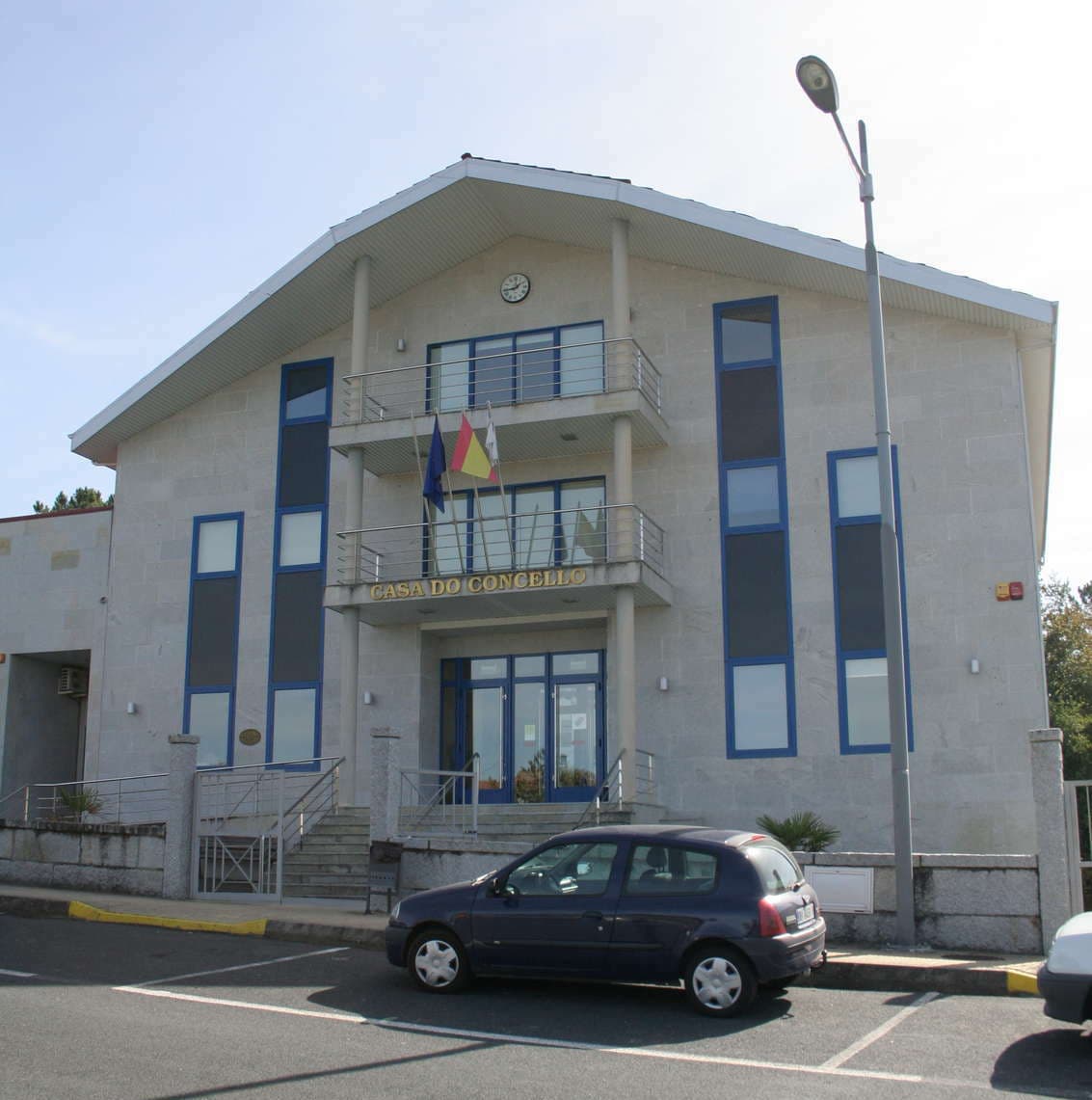
View of VilamarínLa fabrica de nubes · CC BY-SA 4.0

Vilamarín

Village

Vilamarín is a municipality in the province of Ourense, in the autonomous community of Galicia, Spain. It belongs to the Comarca of Ourense. It has a population of 1996 (20166) and an area of 56 km².

Text from Wikipedia (CC BY-SA)

Village information

Coat of arms of Vilamarín
Province
Ourense
Autonomous community
Galicia
Population (INE 2025)
1,836
Altitude
504 m
Area (IGN)
59 km²
View on the map
  • Overview
  • See and do
  • Events
  • Stay
  • Eat
  • Live here
  • Opportunities
  • Practical info
  • Gallery

Keep exploring

More villages near Vilamarín

Surprise me
Lameiro · Public domainSan Cristovo de CeaOurense · 7.6 km away
Luis Miguel Bugallo Sánchez (Lmbuga) · CC BY-SA 4.0AmoeiroOurense · 7.9 km away
Chairego apc · CC BY 4.0ColesOurense · 8.4 km away
Satna · CC BY-SA 4.0A PeroxaOurense · 8.4 km away

Where to sleep in Vilamarín

3 registered places to stay

See places to stay
PreviousOverviewBack to homeNextEvents

What to see

10 places to explore Vilamarín at your own pace. Each number matches its point on the map.

Ask Poblete for a route

Tell me how much time you have and what you like, and I'll put the places in Vilamarín in order so you don't go back and forth.

How much time do you have?
How are you getting around?
What do you like? (you can pick several)

Only with places listed for Vilamarín.

My route around Vilamarín

Tap “+ Add to my route” on the places you want to see. We'll split what you can do on foot from what's better by car.

Places you can add

  1. 1

    1.

    Castillo

  2. 2

    2.

    Museo

  3. 3

    3.

    Museo

  4. 4

    4.

    Yacimiento

  5. 5

    5.

    Yacimiento

  6. 6

    6.

    Yacimiento

  7. 7

    7.

    Yacimiento

  8. 8

    8.

    Yacimiento

  9. 9

    9.

    Iglesia

  10. 10

    10.

    Iglesia

What to do

3 plans to experience Vilamarín on the move, not just passing through.

Hiking

1 activity

Hiking: Camino Sanabrés (Oeste)

More routes on WikilocHiking routes on Google Maps

Natural areas

1 activity

Reserva da Biosfera Ribeira Sacra e Serras do Oribio e Courel

Getting there

Bike

1 activity

MTB: Mtb Camino Sanabrés

Cycling routes on Google Maps

Places and plans from OpenStreetMap (ODbL): what is mapped within the municipal boundary, by name. If something is missing, it can be added there and will appear here in the next update.

In and around Vilamarín

What there really is in the village and around it, with distances. If an activity isn't on this list, we haven't found it nearby.

  • Horse ridingCentro Ecuestre Equus Ourense · in the villageGetting there
  • WineriesBodega Os Castros · 10.9 km away, in Pereiro de Aguiar (O) · 10 within 15 kmGetting there
  • Canoeing and kayakingEscola Ourensá de Piragüismo · 12.3 km away, in OurenseGetting there
  • Spas and hot springsZona Termal do Muíño da Veiga · 12.6 km away, in Ourense · 9 within 25 kmGetting there
  • Reservoirs and lakesEncoro dos Peares · 13.7 km away, in CarballedoGetting there
  • ClimbingCanóns do Sil · 15.8 km away, in Nogueira de RamuínGetting there
  • GolfMontealegre Club de Golf · 16.7 km away, in Ourense · 2 within 20 kmGetting there
  • Rafting and canyoningUnnamed on the map · 19.5 km away, in Sober · 2 within 25 kmGetting there