FavouritesSign inCreate accountAdd my village

The guide to Spain's villages, one municipality at a time.

Your village is waiting for you.

@8000pueblos

Explore

  • Villages
  • Create my route
  • Experiences

Practical guide

  • Guides
  • About us
  • How it works
  • Village comparison
  • Map of Spain
  • Opportunities
  • Living in a village

Join us

  • Create your account
  • For town councils
  • For professionals
  • Contact

© 2026 8000pueblos.com

Some links are affiliate links: if you book, we receive a commission at no cost to you.

SupportPrivacyTermsCookiesLegal notice
en
  • Español
  • English
  • Français
  • Português
  • Italiano
Sign inCreate account
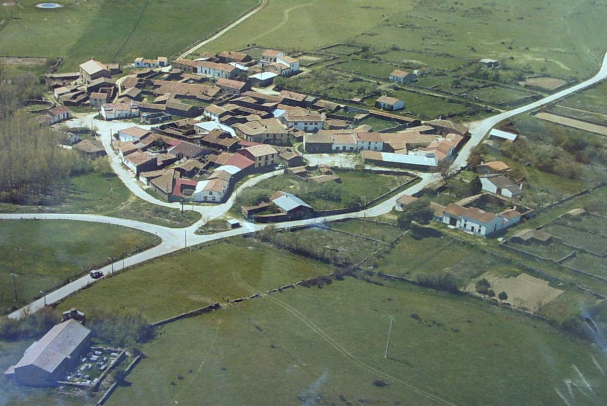
View of BarbalosJecuchi · Public domain

Barbalos

Hamlet

Barbalos is a village and municipality in the province of Salamanca, western Spain, part of the autonomous community of Castile-Leon. It is located 45 kilometres (28 mi) from the city of Salamanca and has a population of 78 people. The municipality covers an area of 38 km2 (15 sq mi).

Read moreRead less

The village lies 915 metres (3,002 ft) above sea level.

The postal code is 37455.

Text from Wikipedia (CC BY-SA)

Village information

Province
Salamanca
Autonomous community
Castilla y León
Population (INE 2025)
70
Altitude
904 m
Area (IGN)
39.1 km²
Postcode
37455
View on the map
  • Overview
  • See and do
  • Events
  • Stay
  • Eat
  • Live here
  • Opportunities
  • Practical info
  • Gallery

What to see

One place worth the walk in Barbalos.

My route around Barbalos

Tap “+ Add to my route” on the places you want to see. We'll split what you can do on foot from what's better by car.

Places you can add

  1. 1

    1.

    Iglesia

What to do

We're completing the Barbalos guide village by village.

In and around Barbalos

What there really is in the village and around it, with distances. If an activity isn't on this list, we haven't found it nearby.

  • Horse ridingPicadero J. A. Escudero · 13.3 km away, in Tamames · 2 within 15 kmGetting there

Places and plans from OpenStreetMap (ODbL): what is mapped within the municipal boundary, by name. If something is missing, it can be added there and will appear here in the next update.

More walks near Barbalos

Routes shared by hikers and waymarked trails, with their map and elevation profile.

See routes on WikilocHiking routes on Google Maps

Keep exploring

More villages near Barbalos

Surprise me
Rodelar · CC BY-SA 4.0Narros de MatalayeguaSalamanca · 2.7 km away
Rodelar · CC BY-SA 4.0Berrocal de HuebraSalamanca · 6.6 km away
Caoticainma · Public domainEscurial de la SierraSalamanca · 6.8 km away
Hovallef · CC BY-SA 4.0La SierpeSalamanca · 8.1 km away
PreviousOverviewBack to homeNextEvents