FavouritesSign inCreate accountAdd my village

The guide to Spain's villages, one municipality at a time.

Your village is waiting for you.

@8000pueblos

Explore

  • Villages
  • Create my route
  • Experiences

Practical guide

  • Guides
  • About us
  • How it works
  • Village comparison
  • Map of Spain
  • Opportunities
  • Living in a village

Join us

  • Create your account
  • For town councils
  • For professionals
  • Contact

© 2026 8000pueblos.com

Some links are affiliate links: if you book, we receive a commission at no cost to you.

SupportPrivacyTermsCookiesLegal notice
en
  • Español
  • English
  • Français
  • Português
  • Italiano
Sign inCreate account
View of Beceitejordi domènech · CC BY-SA 3.0

Beceite

Village

Beceite (Spanish) or Beseit (Catalan) is a municipality located in the Matarraña/Matarranya comarca, province of Teruel, Aragon, Spain. According to the 2004 census (INE), the municipality has a population of 603 inhabitants. It is part of the Taula del Sénia free association of municipalities.

Read moreRead less

This town gives its name to the Ports de Beseit massive limestone mountain range rising around it. It belongs to the Catalan-speaking strip in eastern Aragon known as La Franja.

There are many derelict paper mills in Beseit, reminders of what used to be an industrial town. One of the main products was card stock, which was exported for manufacturing playing cards. The former mills were powered by the water of the Matarranya River and its tributaries. Some of them have been converted into hotels catering for rural tourism.

The rocky Penyagalera mountain rises 4 km (2.5 mi) east of the town.

Text from Wikipedia (CC BY-SA)
Village information

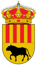
Coat of arms of Beceite
Province
Teruel
Autonomous community
Aragón
Population (INE 2025)
572
Altitude
556 m
Area (IGN)
96.6 km²
Postcode
44588
View on the map
  • Overview
  • See and do
  • Events
  • Stay
  • Eat
  • Live here
  • Opportunities
  • Practical info
  • Gallery

Keep exploring

More villages near Beceite

Surprise me
Olisacu · CC BY-SA 4.0ValderrobresTeruel · 5.3 km away
Angela Llop · CC BY-SA 2.0FuentespaldaTeruel · 10 km away
Juan Emilio Prades Bel · CC BY 4.0CretasTeruel · 11 km away
Millars · CC BY-SA 3.0 esLa PortelladaTeruel · 12 km away

Where to sleep in Beceite

44 registered places to stay

See places to stay
PreviousOverviewBack to homeNextEvents

What to see

15 places to explore Beceite at your own pace. Each number matches its point on the map.

Ask Poblete for a route

Tell me how much time you have and what you like, and I'll put the places in Beceite in order so you don't go back and forth.

How much time do you have?
How are you getting around?
What do you like? (you can pick several)

Only with places listed for Beceite.

My route around Beceite

Tap “+ Add to my route” on the places you want to see. We'll split what you can do on foot from what's better by car.

Places you can add

  1. 1

    1.

    La Fenellosa o La Fenellassa es un panel rocoso de pinturas rupestres pertenecientes al estilo esquemático. Está situado en el término municipal de Beceite, en la Provincia de Teruel en España.

    Cueva con arte prehistóricoBien de interés cultural

    La Fenellosa
    Clemens Schmillen · CC BY-SA 4.0
  2. 2

    2.

    El fuerte de Cabrera es un fuerte de las guerras carlistas situado en la ladera de un monte conocido como El Parrizal, cerca de Beceite (Teruel).

    FuerteBien de interés cultural

    Fuerte de Cabrera
    Deosringas · CC BY-SA 3.0 es
  3. 3

    3.

    Casa consistorialBien de interés cultural

    Casa consistorial de Beceite
    Wikimedia Commons · CC BY-SA 3.0
  4. 4

    4.

    Conjunto históricoBien de interés cultural

    Conjunto Histórico Artístico la Villa de Beceite
    Juan E. M. · CC BY-SA 3.0
  5. 5

    5.

    IglesiaBien de interés cultural

    Iglesia de San Bartolomé
    Wikimedia Commons · CC BY-SA 3.0
  6. 6

    6.

    Puente carreteroBien de interés cultural

    Puente de Piedra
    Jvbct · CC BY-SA 4.0
  7. 7

    7.

    Museo

  8. 8

    8.

    Yacimiento

  9. 9

    9.

    Muralla

  10. 10

    10.

    Cueva

  11. 11

    11.

    Cueva

  12. 12

    12.

    Cueva

  13. 13

    13.

    Cueva

  14. 14

    14.

    Cueva

  15. 15

    15.

    Cueva

Monuments from Wikidata; summaries from Wikipedia (CC BY-SA) and photos from Wikimedia Commons, credited to their authors.

What to do

6 plans to experience Beceite on the move, not just passing through.

Hiking

3 activities

Hiking: Estels del Sud

Hiking: Unió GR 7 i GR 8

Hiking: Camino Natural del Matarraña - Algars

More routes on WikilocHiking routes on Google Maps

Natural areas

1 activity

Parque Natural dels Ports

Getting there

Bike

2 activities

MTB: Pedals dels Ports

Cycling route: Vall de l'Algars

Cycling routes on Google Maps

Places and plans from OpenStreetMap (ODbL): what is mapped within the municipal boundary, by name. If something is missing, it can be added there and will appear here in the next update.

In and around Beceite

What there really is in the village and around it, with distances. If an activity isn't on this list, we haven't found it nearby.

  • Reservoirs and lakesEmbalse de Pena · in the villageGetting there
  • WineriesVenta D' Aubert · 8.5 km away, in Cretas · 4 within 15 kmGetting there
  • ClimbingCanal Amunt · 14.7 km away, in Mas de Barberans · 7 within 20 kmGetting there
  • Spas and hot springsFont del Foix · 15 km away, in Mas de BarberansGetting there