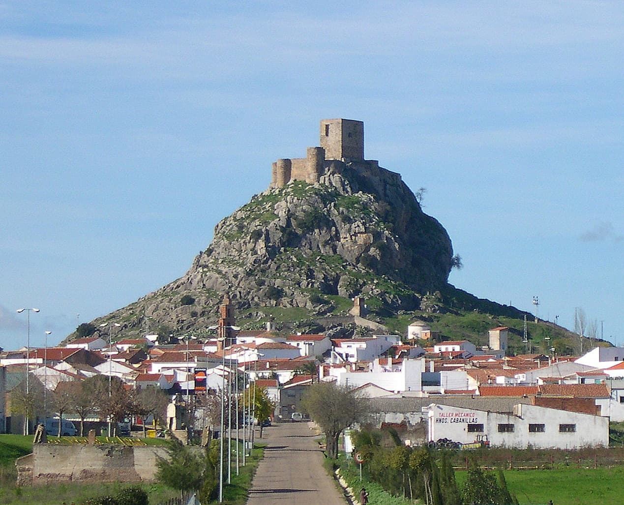
 Rafael Jiménez · CC BY-SA 3.0
Village
Belmez is a village and municipality with 2833 (2025-01-01) inhabitants in Córdoba, Andalucia, Spain.
Belmez is known for its old coal mines, which were in operation for many years and were the main source of income for the village. For this reason, the Practical School for Miners was founded in 1924. It has now become a polytechnic school training civil engineers, energy resource engineers, and mining engineers.
Text from Wikipedia (CC BY-SA)

Keep exploring
7 places to explore Belmez at your own pace. Each number matches its point on the map.

Tell me how much time you have and what you like, and I'll put the places in Belmez in order so you don't go back and forth.
Tap “+ Add to my route” on the places you want to see. We'll split what you can do on foot from what's better by car.
El castillo de Belmez es una fortificación situada en el municipio español de Belmez, en la provincia de Córdoba. Es visible desde cualquier ángulo y se alza sobre la cima de una elevada roca caliza desde la que domina la localidad asentada a sus pies.
CastilloBien de interés cultural

El dolmen de Casas de Don Pedro es un yacimiento arqueológico megalítico que se localiza en el término municipal de Belmez, provincia de Córdoba (España). A pesar de que hubo un asentamiento anterior en el 5000 a.
DolmenBien de interés cultural

La casa consistorial de Belmez es un edificio histórico situado en el municipio español de Belmez, en la provincia de Córdoba. El recinto acoge la sede principal del Ayuntamiento de Belmez.
Casa consistorial

CastilloBien de interés cultural
MuseoCatalogación General
Monumento
Ermita
Monuments from Wikidata; summaries from Wikipedia (CC BY-SA) and photos from Wikimedia Commons, credited to their authors.
One plan to experience Belmez on the move, not just passing through.
1 activity
Places and plans from OpenStreetMap (ODbL): what is mapped within the municipal boundary, by name. If something is missing, it can be added there and will appear here in the next update.
Routes shared by hikers and waymarked trails, with their map and elevation profile.
What there really is in the village and around it, with distances. If an activity isn't on this list, we haven't found it nearby.

