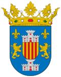
 Alberto-g-rovi · CC BY 3.0
Village
Benabarre (Spanish), in Ribagorçan and Aragonese: Benavarri (locally) is a town and municipality in the Aragonese comarca of Ribagorza, in the province of Huesca, Spain.
Benabarre is the historical and cultural capital of the comarca. It is part of the geo-linguistic area of La Franja, where Ribagorçan dialect of Catalan is spoken. In ancient texts it appears as Benabarri.
It is located in the Pre-Pyrenees, 90 km from Huesca and 65 km from Lleida, at an altitud of 792 m, in a small syncline between Ésera and Cajigar rivers. Most of the territory, however, belongs to the Noguera Ribagorçana basin. To the north we find the Castillo de Laguarres mountain range, and to the south we find the Montsec Range. Through its municipal area runs the N-230 road, that connects Lleida and the Val d'Aran.
Text from Wikipedia (CC BY-SA)
Keep exploring
13 places to explore Benabarre at your own pace. Each number matches its point on the map.

Tell me how much time you have and what you like, and I'll put the places in Benabarre in order so you don't go back and forth.
Tap “+ Add to my route” on the places you want to see. We'll split what you can do on foot from what's better by car.
El castillo de Benabarre, también conocido como castillo de los Condes de Ribagorza, es un castillo medieval que se encuentra en la localidad de Benabarre, perteneciente a la provincia de Huesca, en Aragón.
CastilloBien de interés cultural

La ermita de Nuestra Señora del Plá (Pllà, en catalán bajorribagorzano) es una ermita situada en la localidad española de Purroy de la Solana, en Benabarre, Huesca, Aragón.
Ermita

CastilloBien de interés cultural
CastilloBien de interés cultural
La ermita de San Medardo es un templo barroco del siglo XVII ubicado en Benabarre, Huesca.
Ermita
Castillo
Monasterio
Museo
Yacimiento
Yacimiento
Yacimiento
Iglesia
Iglesia
Monuments from Wikidata; summaries from Wikipedia (CC BY-SA) and photos from Wikimedia Commons, credited to their authors.
5 plans to experience Benabarre on the move, not just passing through.
3 activities
2 activities
Places and plans from OpenStreetMap (ODbL): what is mapped within the municipal boundary, by name. If something is missing, it can be added there and will appear here in the next update.
What there really is in the village and around it, with distances. If an activity isn't on this list, we haven't found it nearby.

