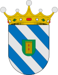
 JAVITROM2014 · CC BY-SA 3.0 es
Village
Biota is a municipality of Spain belonging to the province of Zaragoza, autonomous community of Aragon. The town is part of the Cinco Villas Region and it is located on the banks of the Arba de Luesia River. It has an area of 128.8 km2 with a population of 912 inhabitants.
Text from Wikipedia (CC BY-SA)
Keep exploring
12 places to explore Biota at your own pace. Each number matches its point on the map.

Tell me how much time you have and what you like, and I'll put the places in Biota in order so you don't go back and forth.
Tap “+ Add to my route” on the places you want to see. We'll split what you can do on foot from what's better by car.
La iglesia de San Miguel Arcángel se encuentra en el municipio de Biota, en la Provincia de Zaragoza, comunidad autónoma de Aragón, España, ubicada en un llano situado en la zona oriental de las Bardenas de Sádaba en la Comarca de Cinco Villas (Zaragoza), regado por el río Arba de Luesia.
IglesiaBien de interés cultural

El palacio de los Condes de Aranda en Biota (provincia de Zaragoza, España) es una gran edificación civil del siglo XVIII con planta cuadrada y tres alturas construida en sillar perfectamente escuadrado y reforzado en los ángulos, que se comunica a través de un paso en alto con un espectacular…
PalacioBien de interés cultural

Castillo
Palacio
Iglesia
Yacimiento
Yacimiento
Yacimiento
Yacimiento
Mirador
Ermita
Ermita
Monuments from Wikidata; summaries from Wikipedia (CC BY-SA) and photos from Wikimedia Commons, credited to their authors.
We're completing the Biota guide village by village.
Places and plans from OpenStreetMap (ODbL): what is mapped within the municipal boundary, by name. If something is missing, it can be added there and will appear here in the next update.
Routes shared by hikers and waymarked trails, with their map and elevation profile.
What there really is in the village and around it, with distances. If an activity isn't on this list, we haven't found it nearby.

