FavouritesSign inCreate accountAdd my village

The guide to Spain's villages, one municipality at a time.

Your village is waiting for you.

@8000pueblos

Explore

  • Villages
  • Create my route
  • Experiences

Practical guide

  • Guides
  • About us
  • How it works
  • Village comparison
  • Map of Spain
  • Opportunities
  • Living in a village

Join us

  • Create your account
  • For town councils
  • For professionals
  • Contact

© 2026 8000pueblos.com

Some links are affiliate links: if you book, we receive a commission at no cost to you.

SupportPrivacyTermsCookiesLegal notice
en
  • Español
  • English
  • Français
  • Português
  • Italiano
Sign inCreate account
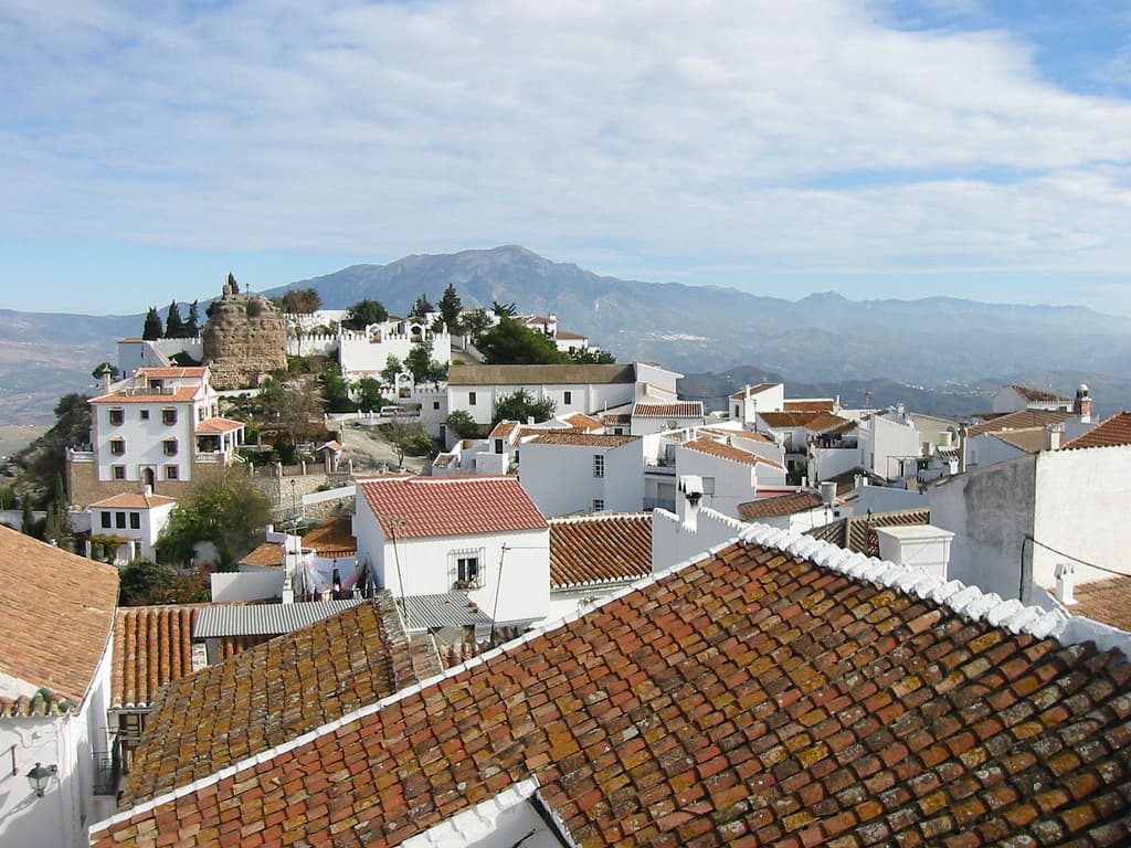
View of ComaresMiguel Frutos · CC BY 2.0

Comares

Village

Comares is a town and municipality in the province of Málaga, part of the autonomous community of Andalusia in southern Spain. The municipality is situated approximately 28 kilometers from the provincial capital and 24 from Vélez-Málaga. It is located in the foothills of the Montes de Málaga 703 meters above sea level. Comares is one of the 31 villages that make up the comarca of Axarquía.

Read moreRead less

It is bordered to the north with Riogordo, to the north, northeast and east with Cútar, to the south with El Borge, to the southwest and west with Málaga and to the northwest with Colmenar.

It has a population of approximately 1,420 residents. The natives are called Moriscosos.

Text from Wikipedia (CC BY-SA)

Village information

Coat of arms of Comares
Province
Málaga
Autonomous community
Andalucía
Population (INE 2025)
1,354
Altitude
692 m
Area (IGN)
25.3 km²
Postcode
29195
View on the map
  • Overview
  • See and do
  • Events
  • Stay
  • Eat
  • Live here
  • Opportunities
  • Practical info
  • Gallery

Keep exploring

More villages near Comares

Surprise me
Dguendel · CC BY 4.0CútarMálaga · 2.6 km away
Dguendel · CC BY 4.0El BorgeMálaga · 4 km away
Dguendel · CC BY 4.0AlmácharMálaga · 5.2 km away
Dguendel · CC BY 4.0BenamargosaMálaga · 5.2 km away

Where to sleep in Comares

101 registered places to stay

See places to stay
PreviousOverviewBack to homeNextEvents

What to see

9 places to explore Comares at your own pace. Each number matches its point on the map.

Ask Poblete for a route

Tell me how much time you have and what you like, and I'll put the places in Comares in order so you don't go back and forth.

How much time do you have?
How are you getting around?
What do you like? (you can pick several)

Only with places listed for Comares.

My route around Comares

Tap “+ Add to my route” on the places you want to see. We'll split what you can do on foot from what's better by car.

Places you can add

  1. 1

    1.

    La iglesia de la Encarnación, en Comares (provincia de Málaga, España), fue erigida en 1505 por mandato del arzobispo de Sevilla don Diego de Deza, con arreglo a la bula de Inocencio VIII y confirmada por bula de Julio II en 1510, sobre la antigua mezquita árabe, formando parte de la Vicaría de…

    Iglesia parroquial católicaBien de interés cultural

    Iglesia de Nuestra Señora de la Encarnación
    Tyk · CC BY-SA 3.0
  2. 2

    2.

    El aljibe de Mazmúllar es un aljibe de origen Mozárabe situado en el municipio de Comares, en la provincia de Málaga, España.

    AljibeBien de interés cultural

  3. 3

    3.

    El castillo de Comares, también denominado baluarte de la Tahoma o de la Tajoma, son los restos de una fortificación situada en el casco urbano de la localidad malagueña de Comares, España.

    CastilloBien de interés cultural

  4. 4

    4.

    Muralla

  5. 5

    5.

    Muralla

  6. 6

    6.

    Mirador

  7. 7

    7.

    Lugar

  8. 8

    8.

    Monumento

  9. 9

    9.

    Ruinas

Monuments from Wikidata; summaries from Wikipedia (CC BY-SA) and photos from Wikimedia Commons, credited to their authors.

What to do

3 plans to experience Comares on the move, not just passing through.

Street market

1 activity

Street market (Saturdays)

Getting there

Bike

2 activities

Cycling route: La Mina (El Chiquín)

Cycling route: Santopitar

Cycling routes on Google Maps

Places and plans from OpenStreetMap (ODbL): what is mapped within the municipal boundary, by name. If something is missing, it can be added there and will appear here in the next update.

More walks near Comares

Routes shared by hikers and waymarked trails, with their map and elevation profile.

See routes on WikilocHiking routes on Google Maps

In and around Comares

What there really is in the village and around it, with distances. If an activity isn't on this list, we haven't found it nearby.

  • Via ferratasVia ferrata Cueva de la Ventana · in the village · 3 within 25 kmGetting there
  • WineriesBodega Fabio Coullet · 5 km away, in Almáchar · 2 within 15 kmGetting there
  • Reservoirs and lakesPantano de La Viñuela · 5.9 km away, in ViñuelaGetting there
  • Spas and hot springsZwavelbad · 11.9 km away, in PerianaGetting there
  • GolfAñoreta Golf · 13.5 km away, in Rincón de la Victoria · 2 within 20 kmGetting there
  • Horse ridingGallardo · 14.6 km away, in Vélez-MálagaGetting there
  • ClimbingCueva del Chamizo · 16.2 km away, in Villanueva del Rosario · 8 within 20 kmGetting there
  • Water parksAquavelis · 17.2 km away, in Vélez-MálagaGetting there
  • Sailing and water sportsPuerto Deportivo del Candado · 17.3 km away · 2 within 20 kmGetting there