FavouritesSign inCreate accountAdd my village

The guide to Spain's villages, one municipality at a time.

Your village is waiting for you.

@8000pueblos

Explore

  • Villages
  • Create my route
  • Experiences

Practical guide

  • Guides
  • About us
  • How it works
  • Village comparison
  • Map of Spain
  • Opportunities
  • Living in a village

Join us

  • Create your account
  • For town councils
  • For professionals
  • Contact

© 2026 8000pueblos.com

Some links are affiliate links: if you book, we receive a commission at no cost to you.

SupportPrivacyTermsCookiesLegal notice
en
  • Español
  • English
  • Français
  • Português
  • Italiano
Sign inCreate account
View of DurangoZarateman · CC0

Durango

Town

Durango is a town and municipality of the historical territory and province of Biscay, located in the Basque Country, Spain. It is the main town of Durangaldea, one of the comarcas of Biscay. Because of its economical activities and population, Durango is considered one of the largest towns in Biscay after the ones that compose the conurbation of Greater Bilbao.

Read moreRead less

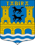
Durango has 29,715 inhabitants (2023). The town is crossed by three rivers (as illustrated in the town symbol). The Ibaizabal river is the main river, and lies in the middle of its wide valley, with the Urkiola mountain range and natural park to the south. The tallest peak is Anboto (1,331 m (4,367 ft) in elevation).

Text from Wikipedia (CC BY-SA)
Village information

Coat of arms of Durango
Province
Bizkaia
Autonomous community
País Vasco
Population (INE 2025)
30,192
Altitude
120 m
Area (IGN)
10.4 km²
District
Duranguesado
Postcode
48200
Demonym
durangués / duranguesa
View on the map
  • Overview
  • See and do
  • Events
  • Stay
  • Eat
  • Live here
  • Opportunities
  • Practical info
  • Gallery

What to see

  1. 1Basílica de Santa María de Uribarri
  2. 2Cruz de Kurutziaga
  3. 3Iglesia de Santa Ana
  4. 4Torre de Laritz
  5. 5Monolito en memoria a las personas represaliadas por el franquismo por su opción sexual
  6. 6Iglesia de San Pedro de Tavira
Data from WikidataSee more

What to do

  1. 1Hiking: GR 229 · Mikeldi Durangaldea
  2. 2Hiking: GR 38 · Ruta del vino y del pescado
  3. 3Parque Natural de Urkiola
  4. 4Hiking: PR-BI 82 · El camino de los carboneros
  5. 5Bodega Bikandi Txakolina
  6. 6Street market
Data from OpenStreetMapSee more

Photo gallery

See all photos
  • Etxaburu (Etxaburu (talk)) · CC BY-SA 4.0
  • Mikel Iturbe Urretxa · CC BY 4.0
  • Wikimaribarre · CC BY-SA 4.0
  • Wikimaribarre · CC BY-SA 4.0
  • Wikimaribarre · CC BY-SA 4.0
  • Tiia Monto · CC BY-SA 3.0
  • 7 places to stayIllustrative photo · Basotxerri · CC BY-SA 4.0

    Accommodation

    7 places to stay in Durango

    See places to stay
  • 28 restaurantsIllustrative photo · David Adam Kess · CC BY-SA 4.0

    Eat

    28 restaurants in Durango

    See where to eat
  • 8 experiencesIllustrative photo · Àngela Llop · CC BY-SA 4.0

    Experiences

    8 experiences in Durango

    See experiences

Useful information

Everything you need for your visit or your day-to-day

Tap a row to see it on the map and how far away it is.

Town council

    • Phone: 946 03 00 00
    • Official website: www.durango.eus
    • Website: www.durango-udala.net
    • Email: durango@durango-udala.net

Services and transport

Travelling with your pet

Parks, beaches and places to stay that OpenStreetMap marks as dog-friendly. Many places allow dogs without it being marked: ask when you book.

Education, sport and elderly care

Connectivity

  • Fibre broadband· of homes98 %
  • 4G mobile coverage· of homes100 %
  • 5G coverage· of homes100 %

No data on: tourist office, ATMs, EV chargers, motorhomes, street market, nursery school.

Data from OpenStreetMap (ODbL), extract from October 2026: we count what is mapped within the municipal boundary. "No data" means OpenStreetMap doesn't have it, not that it doesn't exist. Completed with Overture Maps (CDLA-Permissive-2.0): the pharmacies, health centres, petrol stations, banks, cash machines, food shops and schools that OpenStreetMap was missing. Town hall contact details: General Database of Local Entities (Spanish Ministry of Finance); tourist offices: each region's open registry, where it publishes one. Connectivity: Spanish Ministry for Digital Transformation, % of homes covered in June 2025.

Durango Town Hall

Municipal information, services, procedures and grants.

Go to municipal information

Keep exploring

More villages near Durango

Surprise me
Txo · Public domainIurretaBizkaia · 0.9 km away
Assar · CC BY-SA 3.0IzurtzaBizkaia · 2 km away
Txo · CC BY-SA 4.0AbadiñoBizkaia · 2.8 km away
Txo · Public domainGaraiBizkaia · 3.4 km away

Where to sleep in Durango

7 registered places to stay

See places to stay
Back to homeNextSee and do