FavouritesSign inCreate accountAdd my village

The guide to Spain's villages, one municipality at a time.

Your village is waiting for you.

@8000pueblos

Explore

  • Villages
  • Create my route
  • Experiences

Practical guide

  • Guides
  • About us
  • How it works
  • Village comparison
  • Map of Spain
  • Opportunities
  • Living in a village

Join us

  • Create your account
  • For town councils
  • For professionals
  • Contact

© 2026 8000pueblos.com

Some links are affiliate links: if you book, we receive a commission at no cost to you.

SupportPrivacyTermsCookiesLegal notice
en
  • Español
  • English
  • Français
  • Português
  • Italiano
Sign inCreate account
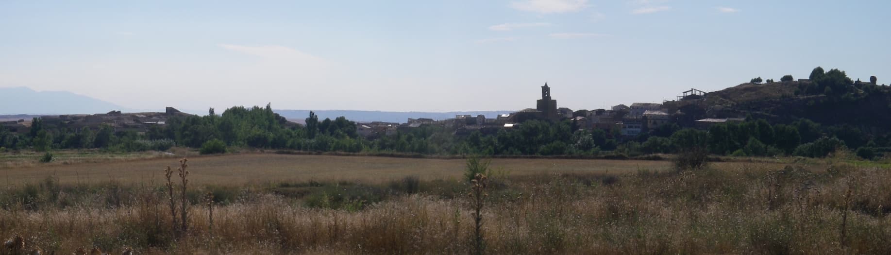
View of ErlaDeivid · CC BY-SA 4.0

Erla

Mountain village

Erla is a municipality in the province of Zaragoza, Aragon, Spain. According to the 2004 census (INE), the municipality has a population of 438 inhabitants.

Text from Wikipedia (CC BY-SA)

Village information

Coat of arms of Erla
Province
Zaragoza
Autonomous community
Aragón
Population (INE 2025)
374
Altitude
430,376 m
Area (IGN)
17.4 km²
Postcode
50611
Demonym
erlana / erlano
View on the map
  • Overview
  • See and do
  • Events
  • Stay
  • Eat
  • Live here
  • Opportunities
  • Practical info
  • Gallery

Keep exploring

More villages near Erla

Surprise me
Fabien LABONNE · CC BY-SA 3.0LunaZaragoza · 5.7 km away
Deivid · CC BY-SA 4.0Sierra de LunaZaragoza · 8.3 km away
Diego Delso · CC BY-SA 4.0ValpalmasZaragoza · 9 km away
Deivid · CC BY-SA 4.0Las PedrosasZaragoza · 11 km away
PreviousOverviewBack to homeNextEvents

What to see

4 places to explore Erla at your own pace. Each number matches its point on the map.

Ask Poblete for a route

Tell me how much time you have and what you like, and I'll put the places in Erla in order so you don't go back and forth.

How much time do you have?
How are you getting around?
What do you like? (you can pick several)

Only with places listed for Erla.

My route around Erla

Tap “+ Add to my route” on the places you want to see. We'll split what you can do on foot from what's better by car.

Places you can add

  1. 1

    1.

    El castillo de Santia o Santias es un castillo medieval situado en el municipio zaragozano de Erla y que se encuentra en grave riesgo de desaparición.

    CastilloBien de interés cultural

    Castillo de Santia
    Arseniog · CC BY-SA 4.0
  2. 2

    2.

    La Torre del Señorío es una puerta-torre situada en Erla (provincia de Zaragoza, España) fue construida en el siglo XV por los López de Gurrea.

    Puerta de la ciudadBien de interés cultural

    Torre del Señorío
    France64160 · CC BY-SA 4.0
  3. 3

    3.

    El castillo palacio de Paúles, era una fortaleza de ya existente en el siglo XI y reconvertida en palacio en el siglo XIX, ubicada el despoblado de Paúles, hoy perteneciente al municipio zaragozano de Erla.

    CastilloBien de interés cultural

  4. 4

    4.

    El castillo de los Luna, o simplemente castillo de Erla, era una fortaleza de origen musulmán ubicada el municipio zaragozano de Erla, en lo alto de un cerro, sobre la población.

    Yacimiento arqueológicoBien de interés cultural

Monuments from Wikidata; summaries from Wikipedia (CC BY-SA) and photos from Wikimedia Commons, credited to their authors.

What to do

We're completing the Erla guide village by village.

More walks near Erla

Routes shared by hikers and waymarked trails, with their map and elevation profile.

See routes on WikilocHiking routes on Google Maps

In and around Erla

What there really is in the village and around it, with distances. If an activity isn't on this list, we haven't found it nearby.

  • Reservoirs and lakesEmbalse de Laverné · 11 km away, in Ejea de los Caballeros · 2 within 15 kmGetting there
  • Sailing and water sportsEmbarcadero · 18.4 km away, in ArdisaGetting there
  • Rafting and canyoningUnnamed on the map · 24 km away, in Murillo de GállegoGetting there