FavouritesSign inCreate accountAdd my village

The guide to Spain's villages, one municipality at a time.

Your village is waiting for you.

@8000pueblos

Explore

  • Villages
  • Create my route
  • Experiences

Practical guide

  • Guides
  • About us
  • How it works
  • Village comparison
  • Map of Spain
  • Opportunities
  • Living in a village

Join us

  • Create your account
  • For town councils
  • For professionals
  • Contact

© 2026 8000pueblos.com

Some links are affiliate links: if you book, we receive a commission at no cost to you.

SupportPrivacyTermsCookiesLegal notice
en
  • Español
  • English
  • Français
  • Português
  • Italiano
Sign inCreate account
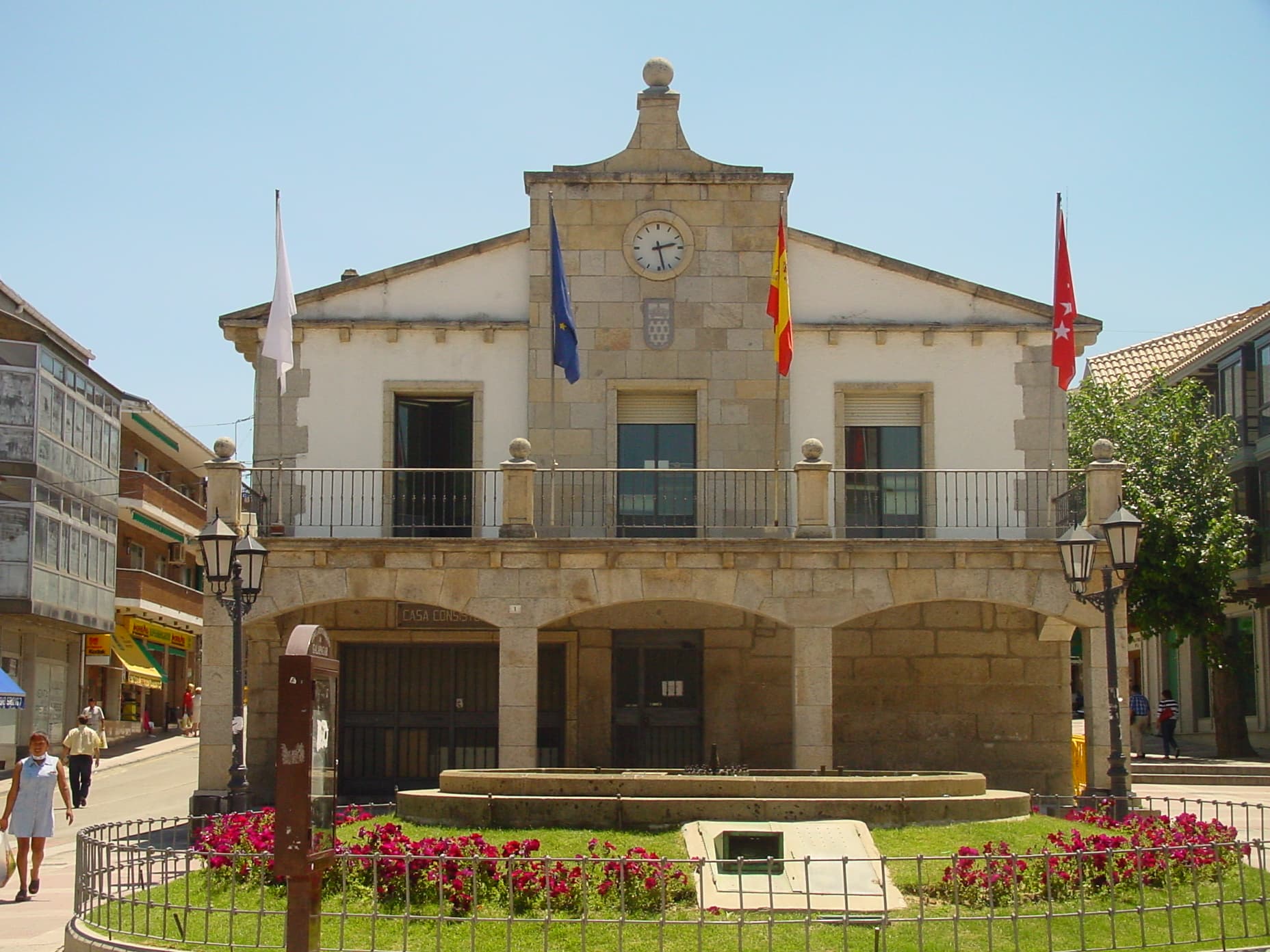
View of GalapagarWikimedia Commons · CC BY 3.0 es

Galapagar

Town

Galapagar is a town and municipality northwest of Madrid, Spain, situated in the autonomous community of the Community of Madrid. Of all the towns in the area, it has experienced the most growth, mostly because of immigration and the development of old livestock fields.

Read moreRead less

Galapagar borders Collado Villalba, Colmenarejo, Torrelodones, Las Rozas de Madrid, El Escorial, San Lorenzo de El Escorial, Villanueva del Pardillo, Hoyo de Manzanares, Moralzarzal and Guadarrama.

The name Galapagar comes from the Spanish galápago, meaning turtle, as the town centre was sited near a lake full of turtles.

The town first appears as a village in the eleventh century, its importance due to the frequent hunting expeditions by the Spanish royalty, and being a main stop on the road from the capital to the Royal Monastery of San Lorenzo de El Escorial. Sights in the town include the church of The Asunción (Assumption).

Galapagar is served by lines C-3, C-8 and C-10 of the Cercanías Madrid commuter rail service at its Galapagar-La Navata train station; and by 9 lines of the Interurban Bus Service linking it to the Moncloa district of Madrid.

Jacinto Benavente, one of the foremost Spanish dramatists of the 20th century and 1922 laurate of the Nobel Prize in Literature, is buried here.

Bullfighting, stock-breeding, pasturing and beef production are the main activities in Galapagar.

Text from Wikipedia (CC BY-SA)

Village information

Coat of arms of Galapagar
Province
Madrid
Population (INE 2025)
36,758
Altitude
884 m
Area (IGN)
66.2 km²
Postcode
28260
View on the map
  • Overview
  • See and do
  • Events
  • Stay
  • Eat
  • Live here
  • Opportunities
  • Practical info
  • Gallery

Keep exploring

More villages near Galapagar

Surprise me
Wikimedia Commons · CC BY 3.0 esColmenarejoMadrid · 2.1 km away
Zarateman · CC0Collado VillalbaMadrid · 5.6 km away
Paconi · CC BY-SA 3.0TorrelodonesMadrid · 6.3 km away
David Mapletoft · CC BY 2.0AlpedreteMadrid · 9.2 km away
PreviousPractical infoBack to home

Gallery

10 photographs of Galapagar, taken here and in its own light.

Wikimedia Commons · CC BY 3.0 es
Galapagar: Ayuntamiento de Galapagar · Photo: Wikimedia Commons (CC BY 3.0 es)
Zarateman · CC0
Galapagar: Galapagar Plaza de la Constitución 3 · Photo: Zarateman (CC0)
Javier Casado Tirado · CC BY-SA 3.0
Galapagar: Galapagar, Madrid, Spain panoramio · Photo: Javier Casado Tirado (CC BY-SA 3.0)
Miguel Iglesias · CC BY-SA 3.0
Galapagar: Galapagar, Madrid, Spain panoramio (4) · Photo: Miguel Iglesias (CC BY-SA 3.0)
Miguel Iglesias · CC BY-SA 3.0
Galapagar, Madrid, Spain · Photo: Miguel Iglesias (CC BY-SA 3.0)
Ricardo Ricote Rodrí… · CC BY 3.0
Barrio de la Estación · Photo: Ricardo Ricote Rodrí… (CC BY 3.0)
Ricardo Ricote Rodrí… · CC BY 3.0
Urbanización ParqueLagos · Photo: Ricardo Ricote Rodrí… (CC BY 3.0)
Ricardo Ricote Rodrí… · CC BY 3.0
Urbanización ParqueLagos · Photo: Ricardo Ricote Rodrí… (CC BY 3.0)
Ricardo Ricote Rodrí… · CC BY 3.0
La Sierra · Photo: Ricardo Ricote Rodrí… (CC BY 3.0)
Miguel Iglesias · CC BY-SA 3.0
Galapagar, February 2006 · Photo: Miguel Iglesias (CC BY-SA 3.0)