FavouritesSign inCreate accountAdd my village

The guide to Spain's villages, one municipality at a time.

Your village is waiting for you.

@8000pueblos

Explore

  • Villages
  • Create my route
  • Experiences

Practical guide

  • Guides
  • About us
  • How it works
  • Village comparison
  • Map of Spain
  • Opportunities
  • Living in a village

Join us

  • Create your account
  • For town councils
  • For professionals
  • Contact

© 2026 8000pueblos.com

Some links are affiliate links: if you book, we receive a commission at no cost to you.

SupportPrivacyTermsCookiesLegal notice
en
  • Español
  • English
  • Français
  • Português
  • Italiano
Sign inCreate account
View of IngenioMololo · CC BY-SA 4.0

Ingenio

Coastal town

Ingenio is a town and a Spanish municipality in the eastern part of the island of Gran Canaria in the Province of Las Palmas in the Canary Islands. Its population is 29,978 (2013), and the area is 38.15 km2 (14.73 sq mi).

Read moreRead less

Ingenio is situated between the mountains and the Atlantic Ocean, 24 km (15 mi) south of the island's capital Las Palmas and 9 km (6 mi) south of Telde. The municipality includes the town Carrizal. The GC-1 motorway passes east of the town, and the Gran Canaria Airport is situated in the eastern part of the municipality. In agriculture, sugar cane is one of the dominant crops in Ingenio.

The municipality is home to the International Folklore Festival which has the participation of music groups worldwide including Mexico, Colombia, Romania, Russia and Uganda.

Text from Wikipedia (CC BY-SA)
Village information

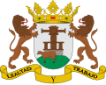
Coat of arms of Ingenio
Province
Las Palmas
Autonomous community
Canarias
Population (INE 2025)
32,905
Altitude
313 m
Area (IGN)
37.8 km²
Postcode
35250
Demonym
ingeniense
View on the map
  • Overview
  • See and do
  • Events
  • Stay
  • Eat
  • Live here
  • Opportunities
  • Practical info
  • Gallery

Keep exploring

More villages near Ingenio

Surprise me
Gerda Arendt · CC BY-SA 4.0AgüimesLas Palmas · 1.8 km away
hh oldman · CC BY 3.0Valsequillo de Gran CanariaLas Palmas · 9.6 km away
H. Zell · CC BY-SA 3.0Santa Lucía de TirajanaLas Palmas · 9.7 km away
Marc Ryckaert (MJJR) · CC BY 3.0San Bartolomé de TirajanaLas Palmas · 13 km away

Where to sleep in Ingenio

6 registered places to stay

See places to stay
PreviousOverviewBack to homeNextEvents

What to see

11 places to explore Ingenio at your own pace. Each number matches its point on the map.

Ask Poblete for a route

Tell me how much time you have and what you like, and I'll put the places in Ingenio in order so you don't go back and forth.

How much time do you have?
How are you getting around?
What do you like? (you can pick several)

Only with places listed for Ingenio.

My route around Ingenio

Tap “+ Add to my route” on the places you want to see. We'll split what you can do on foot from what's better by car.

Places you can add

  1. 1

    1.

    La iglesia de Nuestra Señora de la Candelaria es la parroquia del municipio de Ingenio en la isla de Gran Canaria (Islas Canarias, España).

    Edificio religioso

    Iglesia de Nuestra Señora de la Candelaria
    Felix König · CC BY 3.0
  2. 2

    2.

    La ermita de San Juan Bautista es una pequeña y humilde ermita situada en la montaña de Las Terras del barranco de Guayadeque, perteneciente al término municipal de Agüimes, Gran Canaria, en la comunidad autónoma de Canarias, España.

    Iglesia

  3. 3

    3.

    Museo

  4. 4

    4.

    Museo

  5. 5

    5.

    Museo

  6. 6

    6.

    Iglesia

  7. 7

    7.

    Iglesia

  8. 8

    8.

    Yacimiento

  9. 9

    9.

    Cueva

  10. 10

    10.

    Mirador

  11. 11

    11.

    Mirador

Monuments from Wikidata; summaries from Wikipedia (CC BY-SA) and photos from Wikimedia Commons, credited to their authors.

What to do

7 plans to experience Ingenio on the move, not just passing through.

Hiking

2 activities

Hiking: GR 131 Agaete - El Burreo

Hiking: null

More routes on WikilocHiking routes on Google Maps

Natural areas

2 activities

Monumento Natural del Barranco de Guayadeque

Getting there

Reserva Natural Especial de los Marteles

Getting there

Water

1 activity

Playa del Burrero

Getting there

Bike

2 activities

Cycling route: Guayadeque

Cycling route: Pico de las Nieves * Carrizal

Cycling routes on Google Maps

Places and plans from OpenStreetMap (ODbL): what is mapped within the municipal boundary, by name. If something is missing, it can be added there and will appear here in the next update.

In and around Ingenio

What there really is in the village and around it, with distances. If an activity isn't on this list, we haven't found it nearby.

  • BeachesPlaya de San Agustín · in the village · 24 within 15 kmGetting there
  • WineriesLa Cava de Piñero · 7.1 km away, in Agüimes · 13 within 15 kmGetting there
  • DivingHole in the Wall · 8 km away · 4 within 20 kmGetting there
  • ClimbingPrincipal · 8.1 km away, in Telde · 137 within 20 kmGetting there
  • Sailing and water sportsPuerto Taliarte · 10.6 km away · 5 within 20 kmGetting there
  • SurfingWindsurfing Center · 11.3 km away · 3 within 20 kmGetting there
  • GolfEl Cortijo Golf Center · 11.5 km away, in Telde · 2 within 20 kmGetting there
  • Horse ridingCentro de hípica · 13.6 km away, in Palmas de Gran Canaria (Las) · 2 within 15 kmGetting there
  • Via ferratasVia Ferrata La primera Luna · 15.1 km away, in San Bartolomé de Tirajana · 5 within 25 kmGetting there
  • Water parksAqualand Maspalomas · 22 km away, in San Bartolomé de TirajanaGetting there