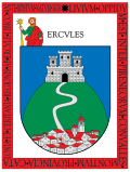
 Medol · CC BY-SA 4.0
Mountain village
Llívia is a town in the comarca of Cerdanya, province of Girona, Catalonia, Spain. It is a Spanish exclave surrounded by the French département of Pyrénées-Orientales. It is named after Livia, the wife of Augustus and matriarch of the Julio-Claudian dynasty. Because of a technicality in the Treaty of the Pyrenees, signed in 1659, that transferred only "villages" in the Pyrenees to France, Llívia, which was a "town", remains under Spanish control. The Segre river, a tributary of the Spanish Ebro, flows through Llívia. It has a population of 1,562 (register office, 2025).
Llívia is separated from the rest of Spain by a corridor approximately 1.6 km (1.0 mile) wide, which includes the French communes of Ur and Bourg-Madame. This corridor is traversed by a road, owned by both France (where it is part of Route nationale 20 and RD68) and Spain (where it is part of N-154). Before the implementation of the Schengen Area in 1995, it was considered a "neutral road", a custom-free route with access for both French and Spanish people; since 1995, there have been no formal borders. The two countries share a hospital in Puigcerdà (which lies close to Llívia), as well as other local initiatives.
Llívia is the site of the Esteve Pharmacy, in Llívia's municipal museum, which has a large albarello display as well as antique drugs and a collection of prescription books. It is also the site of Llívia castle, which is in ruins.
Text from Wikipedia (CC BY-SA)
11 places to stay in Llívia
See places to stay21 restaurants in Llívia
See where to eat3 experiences in Llívia
See experiencesEverything you need for your visit or your day-to-day
Tap a row to see it on the map and how far away it is.
Aparthotel Les Corts· Hotel
Parks, beaches and places to stay that OpenStreetMap marks as dog-friendly. Many places allow dogs without it being marked: ask when you book.
No data on: tourist office, train station, health centre, banks, post office, EV chargers, motorhomes, street market, nursery school, primary school, secondary school, pool, care home.
Data from OpenStreetMap (ODbL), extract from October 2026: we count what is mapped within the municipal boundary. "No data" means OpenStreetMap doesn't have it, not that it doesn't exist. Completed with Overture Maps (CDLA-Permissive-2.0): the pharmacies, health centres, petrol stations, banks, cash machines, food shops and schools that OpenStreetMap was missing. Town hall contact details: General Database of Local Entities (Spanish Ministry of Finance); tourist offices: each region's open registry, where it publishes one. Connectivity: Spanish Ministry for Digital Transformation, % of homes covered in June 2025.
Municipal information, services, procedures and grants.
Keep exploring


