FavouritesSign inCreate accountAdd my village

The guide to Spain's villages, one municipality at a time.

Your village is waiting for you.

@8000pueblos

Explore

  • Villages
  • Create my route
  • Experiences

Practical guide

  • Guides
  • About us
  • How it works
  • Village comparison
  • Map of Spain
  • Opportunities
  • Living in a village

Join us

  • Create your account
  • For town councils
  • For professionals
  • Contact

© 2026 8000pueblos.com

Some links are affiliate links: if you book, we receive a commission at no cost to you.

SupportPrivacyTermsCookiesLegal notice
en
  • Español
  • English
  • Français
  • Português
  • Italiano
Sign inCreate account
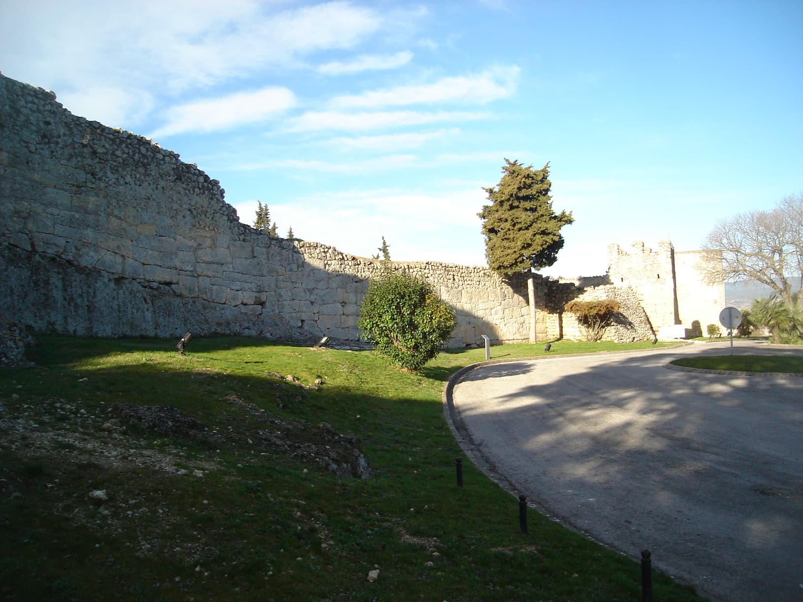
View of OlèrdolaPanotxa · Public domain

Olèrdola

Village

Olèrdola is a municipality in the comarca of the Alt Penedès in Catalonia, Spain. It is situated on the northern side of the Garraf massif, and the highest point of the municipality is the Puig de l'Àliga at 468 m.

Read moreRead less

Olèrdola castle controlled the area of the Penedès Depression in the Early Middle Ages, reaching the height of its significance when its castle dominated the region under the control of the rebellious Mir Geribert, "Prince of Olèrdola". Its importance declined from the twelfth century and its administrative role was taken by Vilafranca del Penedès. The territory has been inhabited since the Neolithic period, and Iberic and Roman remains are juxtaposed with the ruins of the castle. The unusual, circular, Roman chapel of the Sant Sepulcre is near La Plana Rodona.

Text from Wikipedia (CC BY-SA)

Village information

Coat of arms of Olèrdola
Province
Barcelona
Autonomous community
Cataluña
Population (INE 2025)
3,945
Altitude
180 m
Mayor
Josefina Mascaró (Esquerra Republicana de Catalunya)
Area (IGN)
30.6 km²
District
Alto Panadés
Postcode
08734
View on the map
  • Overview
  • See and do
  • Events
  • Stay
  • Eat
  • Live here
  • Opportunities
  • Practical info
  • Gallery

Festivities in Olèrdola: 8 nov (Garraf - Matinal al Parc del Garraf)·See places to stay for those dates

What to see

  1. 1Iglesia de San Miguel
  2. 2Cova dels Segarulls
  3. 3Conjunto monumental de Olérdola
  4. 4Abrigo de Can Castilloví
  5. 5Abrigo de Can Ximet
  6. 6Capilla del Santo Sepulcro
Data from WikidataSee more

What to do

  1. 1Hiking: GR 92.3 · Variant: La Clota - Castellet
  2. 2Hiking: Penedès 360 Trekking
  3. 3Parc d'Olèrdola
  4. 4Hiking: PR-C 143 · Garraf
  5. 5MTB: Penedès 360 Mountain Bike (ruta 5 dies)
  6. 6MTB: Vilafranca - Sant Miquel d'Olèrdola pel camí de la Serreta
Data from OpenStreetMapSee more
  • 8 places to stayIllustrative photo · Rourevell Turisme Ru… · CC BY-SA 3.0

    Accommodation

    8 places to stay in Olèrdola

    See places to stay
  • 3 restaurantsIllustrative photo · Jessica Spengler · CC BY 2.0

    Eat

    3 restaurants in Olèrdola

    See where to eat
  • 8 experiencesIllustrative photo · Alberto-g-rovi · CC BY-SA 3.0

    Experiences

    8 experiences in Olèrdola

    See experiences

Useful information

Everything you need for your visit or your day-to-day

Tap a row to see it on the map and how far away it is.

Town council

    • Phone: 93 890 35 02
    • Official website: www.olerdola.cat
    • Email: olerdola@diba.es

Services and transport

Travelling with your pet

Parks, beaches and places to stay that OpenStreetMap marks as dog-friendly. Many places allow dogs without it being marked: ask when you book.

Education, sport and elderly care

Connectivity

  • Fibre broadband· of homes98 %
  • 4G mobile coverage· of homes100 %
  • 5G coverage· of homes99 %

No data on: tourist office, train station, health centre, banks, ATMs, post office, EV chargers, motorhomes, street market, secondary school, pool, care home.

Data from OpenStreetMap (ODbL), extract from October 2026: we count what is mapped within the municipal boundary. "No data" means OpenStreetMap doesn't have it, not that it doesn't exist. Completed with Overture Maps (CDLA-Permissive-2.0): the pharmacies, health centres, petrol stations, banks, cash machines, food shops and schools that OpenStreetMap was missing. Town hall contact details: General Database of Local Entities (Spanish Ministry of Finance); tourist offices: each region's open registry, where it publishes one. Connectivity: Spanish Ministry for Digital Transformation, % of homes covered in June 2025.

Olèrdola Town Hall

Municipal information, services, procedures and grants.

Go to municipal information

Keep exploring

More villages near Olèrdola

Surprise me
19Tarrestnom65 · CC BY-SA 4.0Vilafranca del PenedèsBarcelona · 3.2 km away
MARIA ROSA FERRE · CC BY-SA 2.0CanyellesBarcelona · 3.9 km away
Pere López Brosa · CC BY-SA 4.0Santa Margarida i els MonjosBarcelona · 5 km away
Pere prlpz · CC BY-SA 4.0Sant Cugat SesgarriguesBarcelona · 5.4 km away

Where to sleep in Olèrdola

8 registered places to stay

See places to stay
Back to homeNextSee and do