FavouritesSign inCreate accountAdd my village

The guide to Spain's villages, one municipality at a time.

Your village is waiting for you.

@8000pueblos

Explore

  • Villages
  • Create my route
  • Experiences

Practical guide

  • Guides
  • About us
  • How it works
  • Village comparison
  • Map of Spain
  • Opportunities
  • Living in a village

Join us

  • Create your account
  • For town councils
  • For professionals
  • Contact

© 2026 8000pueblos.com

Some links are affiliate links: if you book, we receive a commission at no cost to you.

SupportPrivacyTermsCookiesLegal notice
en
  • Español
  • English
  • Français
  • Português
  • Italiano
Sign inCreate account
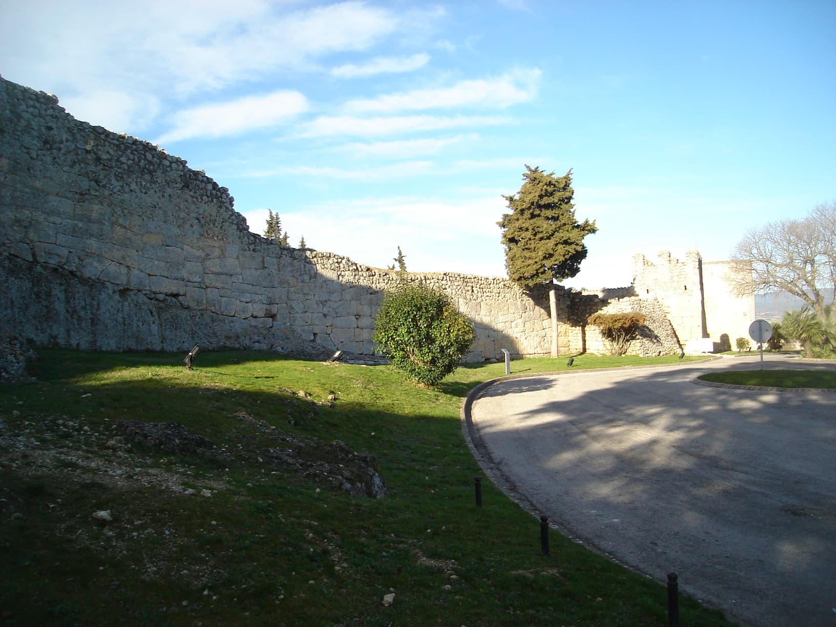
View of OlèrdolaPanotxa · Public domain

Olèrdola

Village

Olèrdola is a municipality in the comarca of the Alt Penedès in Catalonia, Spain. It is situated on the northern side of the Garraf massif, and the highest point of the municipality is the Puig de l'Àliga at 468 m.

Read moreRead less

Olèrdola castle controlled the area of the Penedès Depression in the Early Middle Ages, reaching the height of its significance when its castle dominated the region under the control of the rebellious Mir Geribert, "Prince of Olèrdola". Its importance declined from the twelfth century and its administrative role was taken by Vilafranca del Penedès. The territory has been inhabited since the Neolithic period, and Iberic and Roman remains are juxtaposed with the ruins of the castle. The unusual, circular, Roman chapel of the Sant Sepulcre is near La Plana Rodona.

Text from Wikipedia (CC BY-SA)

Village information

Coat of arms of Olèrdola
Province
Barcelona
Autonomous community
Cataluña
Population (INE 2025)
3,945
Altitude
180 m
Mayor
Josefina Mascaró (Esquerra Republicana de Catalunya)
Area (IGN)
30.6 km²
District
Alto Panadés
Postcode
08734
View on the map
  • Overview
  • See and do
  • Events
  • Stay
  • Eat
  • Live here
  • Opportunities
  • Practical info
  • Gallery

Practical info

The essentials for getting around Olèrdola without surprises: how to get there, municipal facts and when it's most worth coming.

Getting there

Coordinates: 41.3220° N, 1.7231° E

Open in Google MapsView on OpenStreetMap

By bus: check the regional bus timetables, they change by season. If you come without a car, confirm the last service back before you leave.

Useful facts

Postcode
08734
Altitude
180 m
Population (INE 2025)
3,945 inhabitants
District
Alto Panadés
Province / region
Barcelona · Cataluña
Official website
olerdola.cat

Useful phone numbers

  • Emergencies112
  • Poison information91 562 04 20
  • Town councilOn the official website

We only list verified numbers. The town hall itself will give you the number of the clinic or the pharmacy.

When to come

There are no events in Olèrdola's calendar yet, so any month works. Ask us about the local festivals: almost every village has one.

  • Spring

    Fields in bloom and good walking temperatures.

  • Summer

    Hot at midday; festivals tend to cluster in these months.

  • Autumn

    Golden light, mushroom season and fewer visitors.

  • Winter

    Cold and short days. Life gathers in the bar and the square.

Keep exploring

More villages near Olèrdola

Surprise me
19Tarrestnom65 · CC BY-SA 4.0Vilafranca del PenedèsBarcelona · 3.2 km away
MARIA ROSA FERRE · CC BY-SA 2.0CanyellesBarcelona · 3.9 km away
Pere López Brosa · CC BY-SA 4.0Santa Margarida i els MonjosBarcelona · 5 km away
Pere prlpz · CC BY-SA 4.0Sant Cugat SesgarriguesBarcelona · 5.4 km away

Where to sleep in Olèrdola

8 registered places to stay

See places to stay
PreviousOpportunitiesBack to homeNextGallery