 Ziegler175 · CC BY-SA 3.0
Town
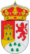
Pizarra is a town and municipality in the province of Málaga, part of the autonomous community of Andalusia in southern Spain. The municipality is situated approximately 30 kilometres from Málaga. It is located in the center of the province and belongs to the comarca of Valle del Guadalhorce.
The town is served by the Málaga Metropolitan Transport Consortium Metropolitan bus lines.
The municipality of Pizarra is located in a strategic area in the Guadalhorce Valley region, between Álora and Cártama. It is 10 km from Álora and around 13 km from Cártama. Pizarra is crossed by the Guadalhorce River along 8.5 kilometres (which has a width of 11.5) and 8 km, from east to west and from north to south, respectively. Pizarra is also surrounded by Almogía, Cártama, Coín, Álora, and Casarabonela.
It is located 80 meters above sea level. Its highest point is in the Sierra de Gibralmora, 447 meters above sea level, which offers, on the side facing Pizarra, a unique landscape of sandstone rocks that is made spectacular by some of the shapes that this rock presents at the top.
Pizarra is very well connected to its capital, Málaga, which is 30 km away and can be reached from the town by road, bus or rail.
Pizarra is a municipality dedicated to irrigation, as it has a municipal surface area of just over 64 km² dedicated to this. The local products of the land are typical of the Guadalhorce Valley, as are the neighbouring towns. In dry land, the most important crops are olive and almond trees, and to a lesser extent, but no less important, cereals and legumes. As for irrigated land, lemon and orange trees predominate.
Text from Wikipedia (CC BY-SA)
43 places to stay in Pizarra
See places to stay16 restaurants in Pizarra
See where to eat4 experiences in Pizarra
See experiencesEverything you need for your visit or your day-to-day
Tap a row to see it on the map and how far away it is.
Parks, beaches and places to stay that OpenStreetMap marks as dog-friendly. Many places allow dogs without it being marked: ask when you book.
No data on: tourist office, motorhomes, street market, care home.
Data from OpenStreetMap (ODbL), extract from October 2026: we count what is mapped within the municipal boundary. "No data" means OpenStreetMap doesn't have it, not that it doesn't exist. Completed with Overture Maps (CDLA-Permissive-2.0): the pharmacies, health centres, petrol stations, banks, cash machines, food shops and schools that OpenStreetMap was missing. Town hall contact details: General Database of Local Entities (Spanish Ministry of Finance); tourist offices: each region's open registry, where it publishes one. Connectivity: Spanish Ministry for Digital Transformation, % of homes covered in June 2025.
Municipal information, services, procedures and grants.
Keep exploring


