 Ziegler175 · CC BY-SA 3.0
Town
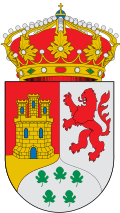
Pizarra is a town and municipality in the province of Málaga, part of the autonomous community of Andalusia in southern Spain. The municipality is situated approximately 30 kilometres from Málaga. It is located in the center of the province and belongs to the comarca of Valle del Guadalhorce.
The town is served by the Málaga Metropolitan Transport Consortium Metropolitan bus lines.
The municipality of Pizarra is located in a strategic area in the Guadalhorce Valley region, between Álora and Cártama. It is 10 km from Álora and around 13 km from Cártama. Pizarra is crossed by the Guadalhorce River along 8.5 kilometres (which has a width of 11.5) and 8 km, from east to west and from north to south, respectively. Pizarra is also surrounded by Almogía, Cártama, Coín, Álora, and Casarabonela.
It is located 80 meters above sea level. Its highest point is in the Sierra de Gibralmora, 447 meters above sea level, which offers, on the side facing Pizarra, a unique landscape of sandstone rocks that is made spectacular by some of the shapes that this rock presents at the top.
Pizarra is very well connected to its capital, Málaga, which is 30 km away and can be reached from the town by road, bus or rail.
Pizarra is a municipality dedicated to irrigation, as it has a municipal surface area of just over 64 km² dedicated to this. The local products of the land are typical of the Guadalhorce Valley, as are the neighbouring towns. In dry land, the most important crops are olive and almond trees, and to a lesser extent, but no less important, cereals and legumes. As for irrigated land, lemon and orange trees predominate.
Text from Wikipedia (CC BY-SA)
Keep exploring
10 places to explore Pizarra at your own pace. Each number matches its point on the map.

Tell me how much time you have and what you like, and I'll put the places in Pizarra in order so you don't go back and forth.
Tap “+ Add to my route” on the places you want to see. We'll split what you can do on foot from what's better by car.
La necrópolis prehistórica del Hacho se ubica en el valle bajo del río Guadalhorce, en una zona estratégica de comunicación en la provincia de Málaga, España. Dicha área funeraria se remonta a la Edad del Cobre Final o al Bronce Inicial.
Cista

El Museo Municipal de Pizarra es un museo de Pizarra. Está ubicado en un Antiguo Cortijo de la localidad, muy cerca de la ciudad de Málaga en la Costa del Sol.
Museo
Yacimiento
Iglesia
Iglesia
Iglesia
Mirador
Monumento
Monumento
Ermita
Monuments from Wikidata; summaries from Wikipedia (CC BY-SA) and photos from Wikimedia Commons, credited to their authors.
4 plans to experience Pizarra on the move, not just passing through.
3 activities
1 activity
Places and plans from OpenStreetMap (ODbL): what is mapped within the municipal boundary, by name. If something is missing, it can be added there and will appear here in the next update.
What there really is in the village and around it, with distances. If an activity isn't on this list, we haven't found it nearby.

