FavouritesSign inCreate accountAdd my village

The guide to Spain's villages, one municipality at a time.

Your village is waiting for you.

@8000pueblos

Explore

  • Villages
  • Create my route
  • Experiences

Practical guide

  • Guides
  • About us
  • How it works
  • Village comparison
  • Map of Spain
  • Opportunities
  • Living in a village

Join us

  • Create your account
  • For town councils
  • For professionals
  • Contact

© 2026 8000pueblos.com

Some links are affiliate links: if you book, we receive a commission at no cost to you.

SupportPrivacyTermsCookiesLegal notice
en
  • Español
  • English
  • Français
  • Português
  • Italiano
Sign inCreate account
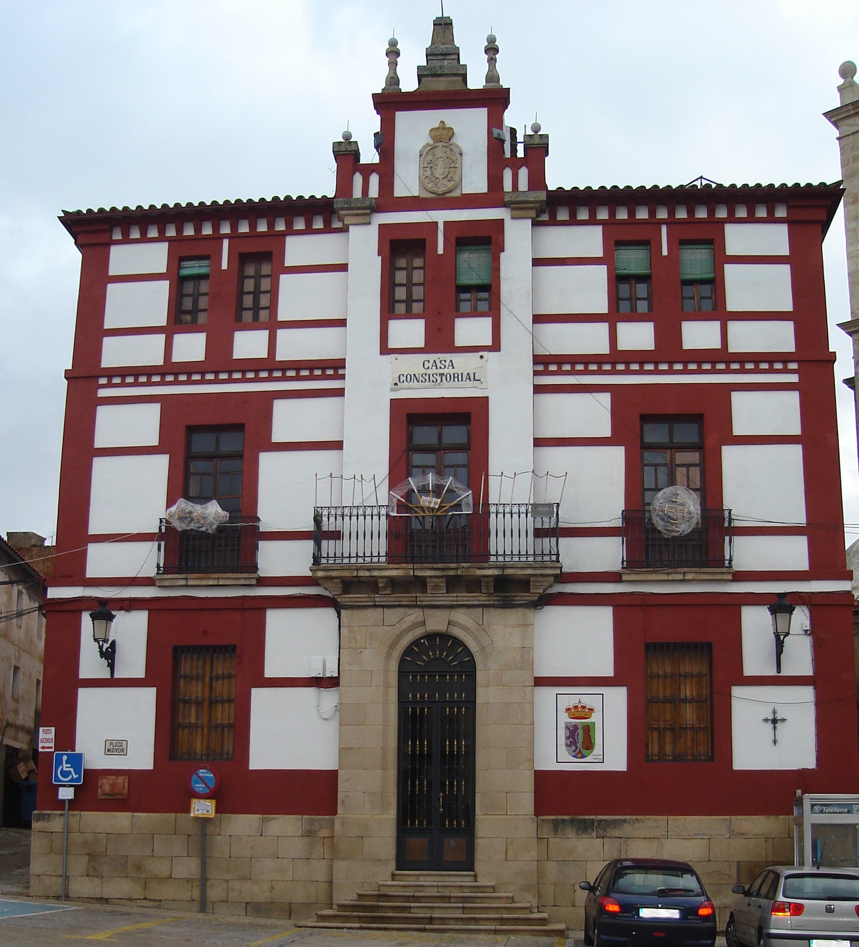
View of TorrejoncilloJosemamc · CC BY-SA 4.0

Torrejoncillo

Village

Torrejoncillo (Spanish:; Extremaduran: Torrojoncillu) is a municipality located in the province of Cáceres, Extremadura, Spain. According to the 2006 census (INE), the municipality has a population of 3350 inhabitants.

Text from Wikipedia (CC BY-SA)

Village information

Coat of arms of Torrejoncillo
Province
Cáceres
Autonomous community
Extremadura
Population (INE 2025)
2,743
Altitude
324 m
Area (IGN)
93.8 km²
Postcode
10839
Demonym
pringones / torrejoncillanos
View on the map
  • Overview
  • See and do
  • Events
  • Stay
  • Eat
  • Live here
  • Opportunities
  • Practical info
  • Gallery

Keep exploring

More villages near Torrejoncillo

Surprise me
Pueblos Caurienses 2017 · CC BY-SA 4.0PortajeCáceres · 8.5 km away
Chemasanco · CC BY 2.0Pedroso de AcimCáceres · 9.2 km away
Carlos Pino Andújar · CC BY-SA 3.0PortezueloCáceres · 9.4 km away
Amfeli · CC BY 4.0HolgueraCáceres · 10 km away

Where to sleep in Torrejoncillo

3 registered places to stay

See places to stay
PreviousOverviewBack to homeNextEvents

What to see

4 places to explore Torrejoncillo at your own pace. Each number matches its point on the map.

Ask Poblete for a route

Tell me how much time you have and what you like, and I'll put the places in Torrejoncillo in order so you don't go back and forth.

How much time do you have?
How are you getting around?
What do you like? (you can pick several)

Only with places listed for Torrejoncillo.

My route around Torrejoncillo

Tap “+ Add to my route” on the places you want to see. We'll split what you can do on foot from what's better by car.

Places you can add

  1. 1

    1.

    La iglesia de San Andrés es la principal iglesia parroquial del municipio español de Torrejoncillo en la provincia de Cáceres. Su construcción se inició en el siglo XVI.

    IglesiaBien de interés cultural

    Iglesia de San Andrés Apóstol
    Josemamc · CC BY-SA 4.0
  2. 2

    2.

    Iglesia

  3. 3

    3.

    Iglesia

  4. 4

    4.

    Ermita

Monuments from Wikidata; summaries from Wikipedia (CC BY-SA) and photos from Wikimedia Commons, credited to their authors.

What to do

We're completing the Torrejoncillo guide village by village.

Places and plans from OpenStreetMap (ODbL): what is mapped within the municipal boundary, by name. If something is missing, it can be added there and will appear here in the next update.

More walks near Torrejoncillo

Routes shared by hikers and waymarked trails, with their map and elevation profile.

See routes on WikilocHiking routes on Google Maps

In and around Torrejoncillo

What there really is in the village and around it, with distances. If an activity isn't on this list, we haven't found it nearby.

  • Reservoirs and lakesEmbalse de Portaje · in the villageGetting there
  • Horse ridingEmbarcadero · in the villageGetting there
  • Rafting and canyoningUnnamed on the map · 6.6 km away, in Coria · 5 within 25 kmGetting there
  • Canoeing and kayakingUnnamed on the map · 6.6 km away, in Coria · 4 within 20 kmGetting there
  • WineriesBodegas Dehesavieja · 10.3 km away, in RiolobosGetting there
  • River beaches and swimming spotsPlaya Fluvial La Isla · 10.7 km away, in CoriaGetting there
  • GolfCampo Municipal de Golf Galisteo · 19.9 km away, in GalisteoGetting there