FavouritesSign inCreate accountAdd my village

The guide to Spain's villages, one municipality at a time.

Your village is waiting for you.

@8000pueblos

Explore

  • Villages
  • Create my route
  • Experiences

Practical guide

  • Guides
  • About us
  • How it works
  • Village comparison
  • Map of Spain
  • Opportunities
  • Living in a village

Join us

  • Create your account
  • For town councils
  • For professionals
  • Contact

© 2026 8000pueblos.com

Some links are affiliate links: if you book, we receive a commission at no cost to you.

SupportPrivacyTermsCookiesLegal notice
en
  • Español
  • English
  • Français
  • Português
  • Italiano
Sign inCreate account
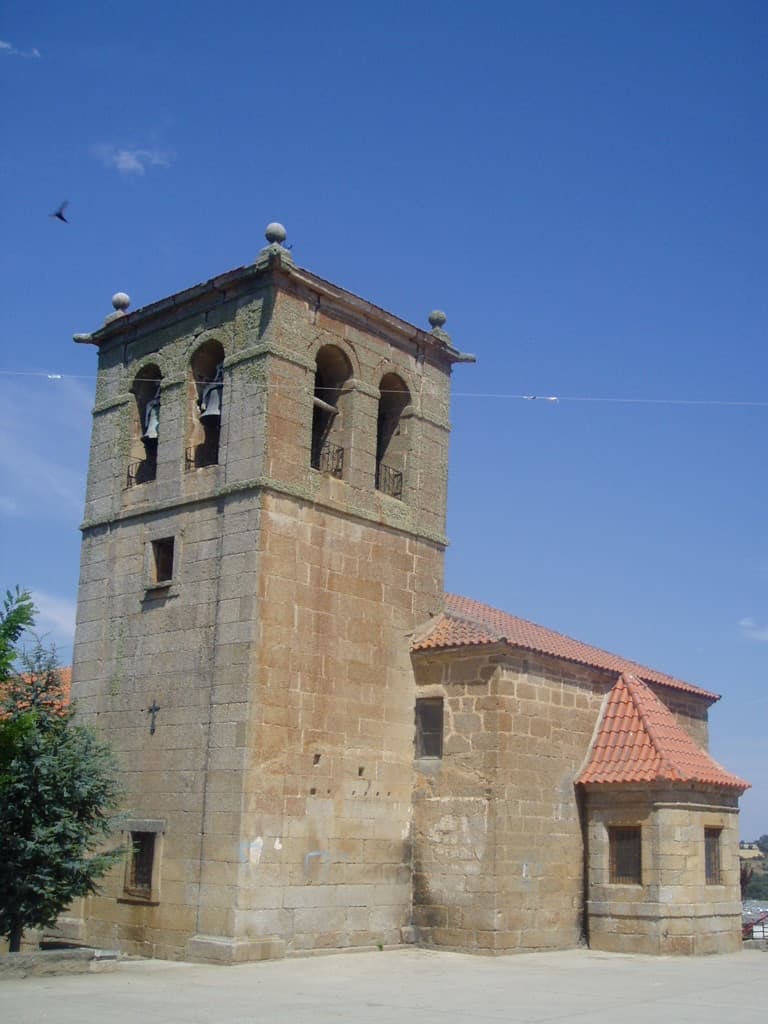
View of VilladeperaMitrídates~commonswiki · Public domain

Villadepera

Village

Villadepera de Sayago is a rural municipality of the Spanish Zamora Province. On January 1, 2025 Villadepera had a total population of 165.

Read moreRead less

Villadepera is situated in a region where the Douro forms narrow canyons for 112 km, and that has now a protected status as the International Douro Natural Park.

Text from Wikipedia (CC BY-SA)

Village information

Province
Zamora
Autonomous community
Castilla y León
Population (INE 2025)
165
Altitude
726 m
Area (IGN)
30 km²
Postcode
49250
View on the map
  • Overview
  • See and do
  • Events
  • Stay
  • Eat
  • Live here
  • Opportunities
  • Practical info
  • Gallery

Keep exploring

More villages near Villadepera

Surprise me
Hovallef · CC BY-SA 4.0Pino del OroZamora · 3.2 km away
Mitrídates~commonswiki · Public domainVillardiegua de la RiberaZamora · 4 km away
Hovallef · CC BY-SA 4.0MoralinaZamora · 6.6 km away
Estevoaei · CC BY-SA 4.0TorregamonesZamora · 8 km away

Where to sleep in Villadepera

1 registered place to stay

See places to stay
PreviousOverviewBack to homeNextEvents

What to see

6 places to explore Villadepera at your own pace. Each number matches its point on the map.

Ask Poblete for a route

Tell me how much time you have and what you like, and I'll put the places in Villadepera in order so you don't go back and forth.

How much time do you have?
How are you getting around?
What do you like? (you can pick several)

Only with places listed for Villadepera.

My route around Villadepera

Tap “+ Add to my route” on the places you want to see. We'll split what you can do on foot from what's better by car.

Places you can add

  1. 1

    1.

    El puente-viaducto de Requejo (también conocido como Puente de Pino) es una obra de ingeniería española construida para salvar el río Duero a su paso por los municipios de Pino del Oro y Villadepera, en la provincia de Zamora, de la comunidad autónoma de Castilla y León, España.

    Puente

    Puente de Requejo
    Mitrídates~commonswiki · Public domain
  2. 2

    2.

    Yacimiento

  3. 3

    3.

    Iglesia

  4. 4

    4.

    Mirador

  5. 5

    5.

    Lugar

  6. 6

    6.

    Molino

Monuments from Wikidata; summaries from Wikipedia (CC BY-SA) and photos from Wikimedia Commons, credited to their authors.

What to do

4 plans to experience Villadepera on the move, not just passing through.

Hiking

2 activities

Hiking: GR 14 · Etapa 22: Villadepera – Villardiegua de la Ribera

Hiking: Ruta de Peña Centigosa a Peña Blanca

More routes on WikilocHiking routes on Google Maps

Natural areas

1 activity

Parque Natural de las Arribes del Duero

Getting there

Bike

1 activity

MTB: Ruta del Duero

Cycling routes on Google Maps

Places and plans from OpenStreetMap (ODbL): what is mapped within the municipal boundary, by name. If something is missing, it can be added there and will appear here in the next update.

In and around Villadepera

What there really is in the village and around it, with distances. If an activity isn't on this list, we haven't found it nearby.

  • Reservoirs and lakesEmbalse de Castro · 1.1 km away, in Moral de Sayago · 4 within 15 kmGetting there
  • River beaches and swimming spotsPlaya del embalse de Ricobayo · 12.6 km away, in Muelas del PanGetting there