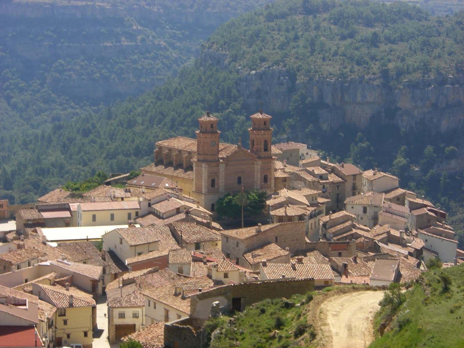
 Joherg · CC BY-SA 4.0
Mountain village
Villarluengo is a municipality at the heart of the mountainous Maestrazgo comarca, province of Teruel, Aragon, Spain. According to the 2010 census the municipality has a population of 188 inhabitants.
Villarluengo is located on top of a spectacular rocky outcrop at the edge of a deep canyon, at the confluence of the Palomita and Cañada rivers. The town is surrounded by mountains, the Sierra de Garrocha, Sierra Carrascosa and Sierra de la Cañada mountain ranges, as well as the Muela Mujer and Muela Mochén mesa type mountains.
The municipal term includes the Las Fábricas abandoned mills and the small village of Montoro de Mezquita.
Text from Wikipedia (CC BY-SA)
Keep exploring
11 places to explore Villarluengo at your own pace. Each number matches its point on the map.

Tell me how much time you have and what you like, and I'll put the places in Villarluengo in order so you don't go back and forth.
Tap “+ Add to my route” on the places you want to see. We'll split what you can do on foot from what's better by car.
El monumento natural de los Órganos de Montoro es una estructura rocosa situada entre los términos municipales de Villarluengo y Ejulve, comarcas de Maestrazgo y Andorra-Sierra de Arcos, provincia de Teruel, Aragón, España.
Monumento natural

Castillo
Muralla
Iglesia
Iglesia
Mirador
Mirador
Mirador
Mirador
Cueva
Monumento
Monuments from Wikidata; summaries from Wikipedia (CC BY-SA) and photos from Wikimedia Commons, credited to their authors.
5 plans to experience Villarluengo on the move, not just passing through.
3 activities
2 activities
Places and plans from OpenStreetMap (ODbL): what is mapped within the municipal boundary, by name. If something is missing, it can be added there and will appear here in the next update.
What there really is in the village and around it, with distances. If an activity isn't on this list, we haven't found it nearby.

