 Zarateman · CC0
Coastal town
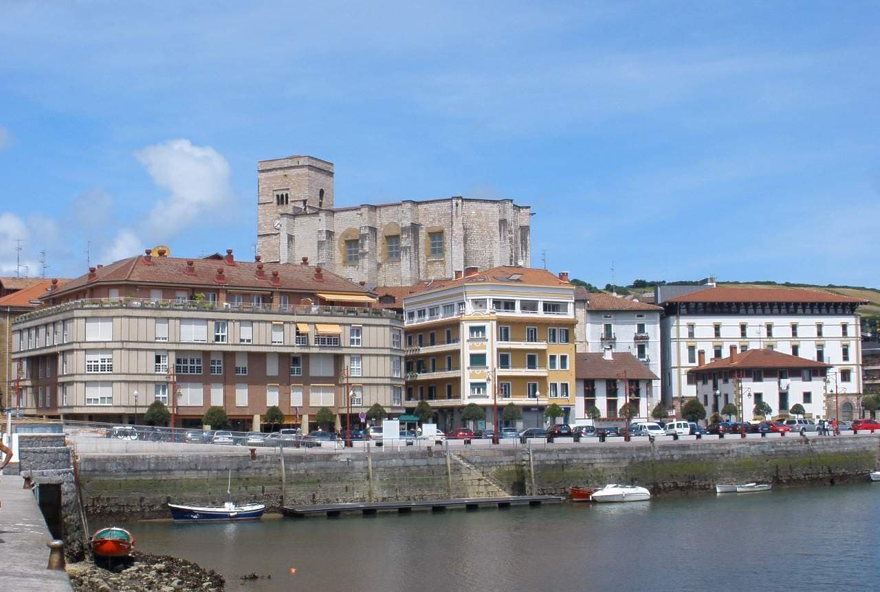
Zumaia is a small town in the north of Spain in the Basque Country.
The town has two beaches (Itzurun and Santiago), which are of interest to geologists because they are situated among the longest set of continuous rock strata in the world. These formations are termed flysch and they date from the mid-cretaceous period to the present, a time period of over 100 million years. The K–T boundary is present at the Itzurun beach, and fossils can be found, notably of ammonites. The strata stretches along a distance of about 8 km, between the beaches of Deba and Getaria, with Zumaia lying in the middle.
The town is also the home-turned-museum of the painter Ignacio Zuloaga. Exhibits include works by El Greco, Rivera, Zurbarán and Goya. Across the street there is a museum of craft and hand-crafted products of Laia. Within the city centre, the Basque-style Gothic church of San Pedro can be found. It has a temple with a magnificent reredos by Juan de Antxieta, the only work by this Basque sculptor found in Gipuzkoa.
Zumaia is located at the point where the Urola and Narrondo rivers come together. The origins of the town can be traced by its ancient monastery. In the Middle Ages, the people who lived in the Sehatz valley having to endure the continuous attacks of pirates and pillagers, fortified the city. The church today retains the relic of its defensive appearance.
Text from Wikipedia (CC BY-SA)

Keep exploring
29 places to explore Zumaia at your own pace. Each number matches its point on the map.

Tell me how much time you have and what you like, and I'll put the places in Zumaia in order so you don't go back and forth.
Tap “+ Add to my route” on the places you want to see. We'll split what you can do on foot from what's better by car.
La iglesia de San Pedro es un inmueble de la localidad española de Zumaya, en la provincia de Guipúzcoa.
IglesiaBien de interés cultural

La Casa de Ubillos es un palacio situado en la localidad de Zumaya, en la comarca de Urola Costa, en Guipúzcoa. El nombre se debe a la familia originalmente propietaria de la misma.
Casa torreBien de interés cultural

El faro de Zumaya es un faro situado en el monte Atalaya, en la localidad de Zumaya, sobre la orilla oeste del estuario del río Urola, en la provincia de Guipúzcoa, País Vasco, España. Está gestionado por la autoridad portuaria del Puerto de Pasajes.
FaroBien inventariado del patrimonio cultural vasco

Museo de estilo historicista.
MuseoBien de interés cultural

Casa, del siglo XVII.
CasaBien de interés cultural

Ermita de estilo románica.
ErmitaParte de un sitio Patrimonio de la Humanidad

PuenteParte de un sitio Patrimonio de la Humanidad

Estación de ferrocarrilBien inventariado del patrimonio cultural vasco

Astillero naval, del siglo XX.
Astillero navalBien inventariado del patrimonio cultural vasco

Centro cultural, del siglo XIX.
Centro culturalBien inventariado del patrimonio cultural vasco

Casa consistorialBien inventariado del patrimonio cultural vasco

Palacio de estilo barroca.
PalacioPatrimonio construido vasco destacado

CaseríoBien inventariado del patrimonio cultural vasco

EdificioBien inventariado del patrimonio cultural vasco

Ermita, del siglo XVI.
ErmitaPatrimonio construido vasco destacado

Patrimonio industrial de estilo Neovasco, del siglo XX.
Patrimonio industrialPatrimonio construido vasco destacado

IglesiaBien inventariado del patrimonio cultural vasco

Palacio de estilo historicista.
PalacioPatrimonio construido vasco destacado

EdificioBien inventariado del patrimonio cultural vasco

Patrimonio industrialPatrimonio construido vasco destacado

Palacio de estilo gótica.
PalacioPatrimonio construido vasco destacado

EdificioBien inventariado del patrimonio cultural vasco

EdificioBien inventariado del patrimonio cultural vasco

ChimeneaBien inventariado del patrimonio cultural vasco

EdificioBien inventariado del patrimonio cultural vasco

Museo
Iglesia
Palacio
Puente
Monuments from Wikidata; summaries from Wikipedia (CC BY-SA) and photos from Wikimedia Commons, credited to their authors.
8 plans to experience Zumaia on the move, not just passing through.
3 activities
1 activity
2 activities
2 activities
Places and plans from OpenStreetMap (ODbL): what is mapped within the municipal boundary, by name. If something is missing, it can be added there and will appear here in the next update.
What there really is in the village and around it, with distances. If an activity isn't on this list, we haven't found it nearby.

